
October 2009
Having reached the end of the Solent Way (and Hampshire) on my last walk I needed to work out a route for this walk. Thankfully, this turned out to be easy because whilst I have finished one long-distance trail (the Solent Way), my onward route takes me onto another long distance trail. This one, the Sussex Border Path. This path was re-launched last year, with signage replaced and a new website and attempts to follow the borders of West and East Sussex to trace a route around the edge of these two counties. Unfortunately, it neglects to include the coastal border of the counties, except for a small stretch east from Emsworth.
That small stretch takes in another island, this one Thorney Island, and this is what I will be following on this walk, so at least I know I have a well-marked trail to follow for my first walk in West Sussex, even if I have to find my own route from then on.
I drove down to Emsworth via the A3, A27 and A259 and parked just off the junction of the A259 and B2148 where there is a pay and display car park. From here I turned left and followed the roads down to the Emsworth Mill Pond, a large pond which seems to take up much of the space in Emsworth.

I followed the eastern side of the pond and soon reached the old part of the village where there is a slipway for launching boats into the harbour.
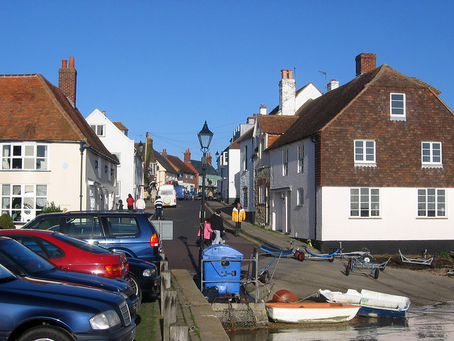
In theory a path runs along the shore in front of the houses here, but the tide was in so it was not possible to try to get this way. Instead I had to head briefly inland via roads to soon reach a second mill pond, this one Slipper Mill Pond. Emsowrth was clearly once a busy place. Now the pond does not seem to be used for anything, but it makes for a nice walk back up to the road.

It turns out there is a small harbour between the road and the edge of the pond, so it is not possible to walk all the way along the shore anyway. I followed the path around the edge of the mill pond with a view out into the wider Chichester harbour ahead.

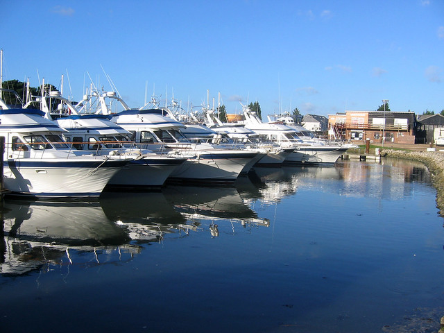
At the eastern end of the pond I can turn right and the path now heads through a posh estate around a marina packed with yachts. A lot of money around here, clearly.
I soon have fine views over Chichester harbour.
The houses in this estate are not that big and raised up on stilts presumably to protect from flooding, with just car parking at the ground floor. It seems a good idea but it does make me wonder if these houses are permanent residences or holiday/weekend homes.

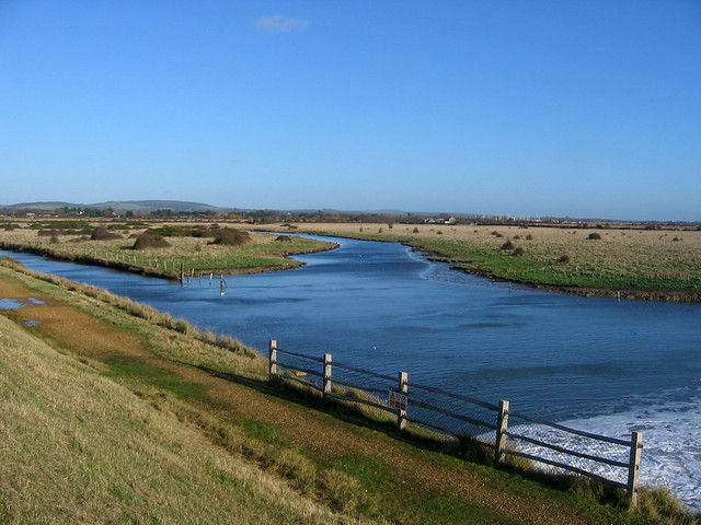
Away from the odd estate I’m now on the sea wall that leads around the western edge of Thorney Island. Thorney Island then, as you may have guessed, is not really an island any longer. It was a marshy tidal island until 1870 when land reclamation of the mud flats meant it became joined to the mainland. The military first took an interest in the site in 1935, with the RAF moving in. In 1984 the army took over from the RAF and they are still in residence today. However the southern part of the island is still almost an island, separated by a wide channel of water known as Great Deep. This used to be crossed via a causeway but now there is a (military) road and the sea walls around the edge provide a bridge for walkers, so it is now possible to walk around the island without needing a boat or getting wet feet.
The sea wall I’m following is raised up and must be the reclaimed land since the land to my left is marshy whilst the harbour is too my right, I am on a little dry causeway.

Once this ends, there is still a water filled ditch between me and the main island, with grazing land beyond.

Emsworth is soon disappearing into the distance and looking back I can see the hills of the South Downs rising up beyond.
A short distance ahead along this sea wall and I reach the Great Deep. And it certainly does look deep, with water rushing under a gap in part of the sea wall below me, so that this channel fills with each high tide.

Just over this there is a high fence, CCTV cameras and an ominous looking gate. A sign warns me that although it is a footpath ahead I am entering MOD land, must stick to the path, that “your progress around the island will be monitored by CCTV”, that it takes 3 hours to walk around and that I my be asked for ID whilst on the island. That is not all, just to get in I must press an intercom to be let through the locked gate. Having read all the notices I pushed the button awaiting a voice to answer (I have heard many walkers report they have been denied access until they provide their name, address and telephone number, which does not seem reasonable). So I am a little nervous I’m going to be asked for such details, which seem unnecessary and unreasonable demands to walk along a public footpath. So it is a relief when I push it, and the person at the other end just responds “I’ve opened the gate, please keep to the path” but does not ask for any further details.
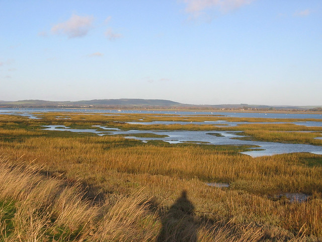
The path continues on the now grassy sea wall. The land to the left is very boggy with parts of it flooded, though there are also cattle grazing.

Parts of the sea wall are lined with old bricks and I wonder where they have come from. Inland there are various buildings visible, but out of bounds to the public. There is a school and sports ground marked on the map though so there is clearly a community of permanent residents, I suspect MOD employees and their families.
I keep to the sea wall (as instructed) to a place called Marker Point. I’m now following the southern coast of the island heading south east. Although the map suggests I should be seeing mud flats, instead there is now a sandy beach. I wonder what the rules on access to the beach are? I suspect access is not permitted but it must be a lovely secluded beach in summer.

The beach now varies between sand and shingle. To my left is a large airfield, presumably from when the island was owned by the RAF but the map shows it as disused now. Signs warn “MOD Property trespassers will be prosecuted, guard dogs on patrol”. Though I haven’t seen any of the CCTV cameras that the sign said would monitor my progress.

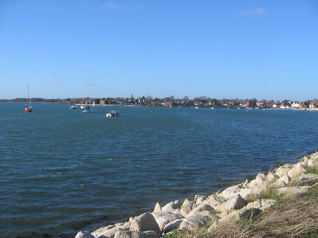
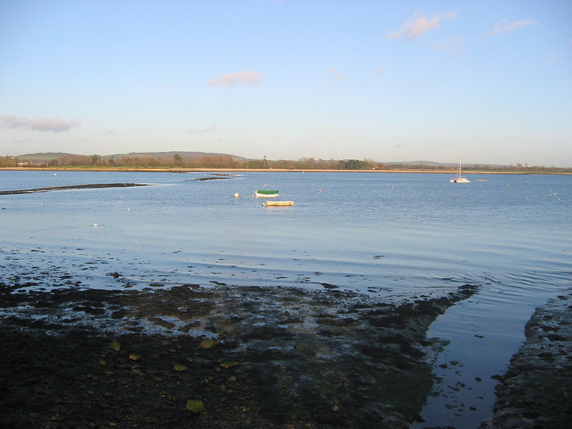
Looking out over the harbour I realise the size and scale of Chichester harbour. Thorney Island is well into the harbour and it is still a couple of miles to the open sea, with just a thin strip of water between Hayling Island and West Wittering providing access to the harbour. I can just make it out on the horizon.
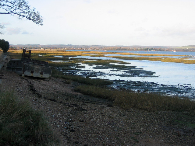
The beach to my right is now mostly bricks, stones and pebbles with just a few areas of sand and in places the sea wall looks to be breaking up.
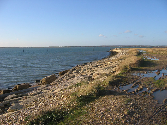
I pass the remains of an old jetty now no longer joined to the land. I keep to the path around the sea wall still past the airport and soon the beach to my right becomes sandy again. Ahead there is now a bird hide as I reach Longmore Point, the southern most point of the island.
In fact just off shore is another island. This is Pilsey Island, though it is possible to walk over to it at most states of the tide. It is owned by the RSPB since 1986. A map shows that no public access is permitted to most of the island (enforced by by-laws) whilst a small area of the beach above mean high water can be accessed between April and October whilst below the high water, on the eastern side of the island, access is permitted year round. These restrictions are due to nesting birds.
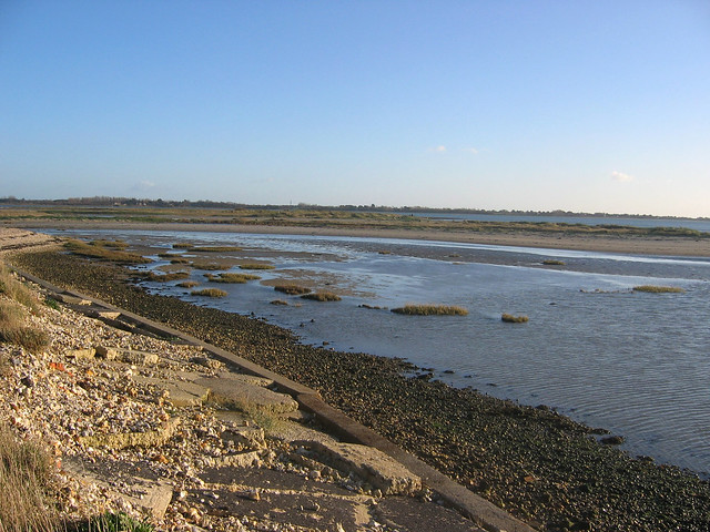
So I give this island a miss since I’m not sure how easy it is to walk over the marsh anyway. So I round the corner, Longmere Point, now heading east over the eastern coast of the island, still on the raised sea wall. Over to my right is another almost island, Chidham. The shore on the eastern side of the island has a lot of marsh alongside it with a couple of marsh islands visible, known as Nutbourne Marsh. It is rather beautiful looking across the harbour. I’m still passing the airport, now more or less at the end of the runway.

I finally reach the end of the runway and come to another village, West Thorney. Why is it called West Thorney given it’s on the east coast of the island I wonder? Like the main village (seemingly just called Thorney Island), this village is also out of bounds to the public. However I soon reach the very pretty church which is clearly very old and right next to the sea wall. It looks an interesting church so I’m pleased to find an information sign with the words “you are very welcome to walk around the church and the cemetery” and even provides the telephone number of the “guard room” where you can request it be unlocked should it be locked.

So I took a look inside and found that it was equally beautiful inside and even decorated with fresh flowers.

It is a lovely spot and very peaceful. A hard here suggests it was once much busier too, but it is deserted (other than me) today.

I continue on the path heading north alongside Nutbourne Marsh with the houses of Chidham visible on the other side of the channel. The path goes around Stanbury Point, a part of the island that juts out into the sea. Just past this I reach the security gate on the other side of the MOD land. Just before I go to press the button, to open the gate, the buzzer sounds and I can push it open. So I was certainly being watched around this part of the island – I wonder for how much of the time?
I cross the Great Deep again and the sun is now getting low as I look over the harbour.

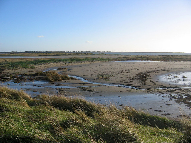
Once over this wide channel of water I reach Thornham Point and turn right to Prinstead point a few metres later. Although marked on the map as dry land this is very marshy again and the path goes over a wooden bridge where the water drains out under the bridge into the harbour.
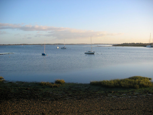
Just past this the path goes through a marina where there are boats both on my left and right.

Once past the marina it is only a few minutes walk to reach the north edge of the island, where there is a small car park at the edge of Prinstead.
Here I left the coast and turned left along Prinstead Lane to a farm where the road turns left to Thornham Grange, but I turn right off it onto a public footpath through a farm yard and across fields near the sewage works. This too is part of the Sussex Border Path which heads back to Emsworth and then turns north towards Westbourne and Rowlands Castle. I follow the path back to the marina with the raised up houses and then follow the roads back to my car in Emsworth.
It has been a lovely introduction to the West Sussex Coast. A look at the map suggested most of the coast of West Sussex is built up so this wonderful peaceful place was a very pleasant surprise. You won’t find any hills here since the island seems to be largely marsh so the walk is not hard (though it can be muddy in places) but it is a place of great beauty as well as a haven for wildlife. The MOD access is in some ways a blessing, since there is a long stretch where there are no roads or other paths, making access difficult and hence few people come here. The church and village at West Thorney was also a very pleasant surprise.
As this is a circular walk there is no need for public transport to get back, but there is a rail station in Emsworth and Southbourne both served by frequent trains from Portsmouth and London Victoria.
Here are the complete set of photos for this walk : Main Link | Slideshow

Pingback: Little Grebe – Thorney Island | Snowgood's Blog