
August 2013
NOTE: Since this walk written a new part of the King Charles the III Coast Path opened (in March 2024) and provided a route much closer to the coast between Kings Lynn and Heacham so this walk has been replaced by new walk 213 & 214. Kings Lynn to Hunstanton which follows the new route nearer the coast and combined the old walks 213 and 214. However I have left this here if anyone wants to read the old route I took.
Having finished the Norfolk Coast path I’d now be following my own route again around an area of the British coast known as The Wash. This is a large estuary or bay, formed by 4 rivers, which separates Norfolk and Linclonshire. It is an area of coast characterised by marshland, reclaimed land, sea walls and agricultural land.
I’ll be honest I wasn’t especially looking forward to walking around The Wash, as when I left the open sea on this walk the next time I’d be alongside it would be Skegness. I’m not sure exactly how far that is to walk, but it can’t be far short of 100 miles.
This was going to be a walk of two halves. The first part along the coast, but after that I’d have to head quite far inland, as there are no paths or even roads along the coast, it is all private land, part of which is the Royal Sandringham Estate.
Once again I was doing this walk from home and as it was the last weekend in August I again travelled by train to Kings Lynn via London Waterloo and London Kings Cross. My train was crowded but arrived at Kings Lynn on time.
Once again (and for the last time), I took the Coasthopper bus back to Hunstanton. As seems to be usual, I ended up standing, just behind the door, all of the way, it was not a comfortable journey.
Still it was a nice day and having been a little rushed last time, I opted to have a bit of a look around Hunstanton first. The green at the back of the beach seemed to be hosting some sort of event. There were old army trucks parked up on the green, but I didn’t find out what the event was.

The town was very pretty and looked to be a well cared for and popular.

I headed down to the shore and back to those remarkable stripy cliffs. Sadly this time, it being the morning, the sun was not shining on the cliffs, so they looked a little duller than last time.

The tide was low this time and it revealed and area of boulders and small white and orange pebbles from the cliffs.
I made my down to the sands and along the beach and the harder sand near the waves. The beach here was rather odd, as it was mostly large sea-weed covered boulders with small gaps of sand between them.


I made my way over this area, stepping over the boulders and walking on the sandy areas as much as possible. It was more like a boulder field!
Having headed a bit away from the cliffs, this now meant I got a fine view of them. Now the border between the orange and white was about 2/3 of the way up the cliff. The cliffs however soon end rather abruptly.
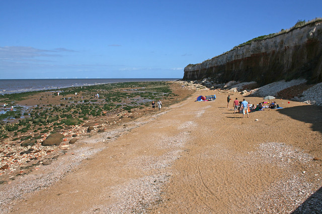
Now it feels more like the resort it really is, with a concrete promenade at the back of the sandy beach, lined with amusements, gardens and car parks.

This was clearly where the best beach was to be found, as the boulder field had ended to be replaced with nice soft sand and wooden groynes.
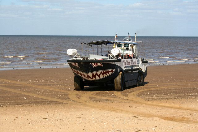
I soon came across a rather more unexpected sight, however. The Wash Monster.

This turns out to be a rather distinctively painted amphibious craft (actually I think there are two) which runs tours around the coast from Hunstanton. At the time I did this walk the company had grand plans to provide a ferry service (for passengers and cars) between Hunstanton and Skegness.
In fact a trial run had been performed the previous weekend by this craft (carrying a car), which was reported by the BBC. On the way back the car was driven via the roads and ended up taking longer than the boat, perhaps to prove a point about how long a journey it is by road. Sadly it seems the plans came to nothing (if they had, I’d have been very tempted to use it, and cut out the walk around the Wash).
Still it looked a fun little trip and I got there just in time to watch it leave.


Hunstanton was proving popular, the beach was busy and so was the promenade. I found myself zig-zagging around between people.

I passed the sea life centre and caravans parks, but soon I was away from the main tourist facilities, and so the promenade and beach were soon far more quiet.

I’m always pleased to find how quiet it gets quickly from the centre of a busy resort, even in the peak of summer, as here.
The beach here became wider and with plenty of firm sand, I left the hard surface of the concrete promenade for the far more pleasant beach.

I’d left the town of Hunstanton now really. However there is a single road, right along the coast lined with houses that joins Hunstanton with Heacham so it’s not really clear to me where one town ends and the next starts. In fact, road is over doing it, it is a gravel track really, though it is a public byway so it is not private. However with a line of houses between it and the coast, I would have limited coastal view so since the tide was out I continued on the beach.
The wooden groynes were now low enough they were easy to just step over.

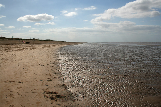
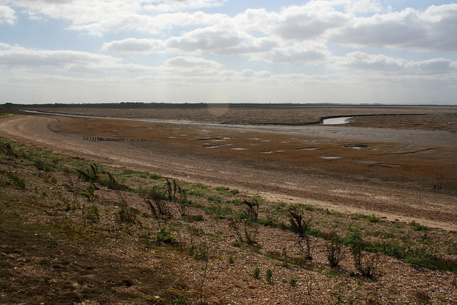
As I headed south the beach became a bit more shingly and with slightly muddy patches in places – signs I was heading into an estuary now.


Soon I saw people again on the sea wall ahead and the reason is there is a large car park and caravan park along the sea front here. This is the edge of the town of Heacham. The main centre is about a mile from the coast, but the edges of the town just reach the coast, which is mostly lined with caravans.
Tufts of grass were now appearing in the wide beach, which had become more sand than mud again.

I briefly had to head onto the promenade to get around a jetty, but then returned to the beach. Heacham is all very low rise and from the shore I couldn’t really see much of it, apart from the roofs of a few of the buildings (mostly bungalows) and caravans.

At the south end of the town I’d reached South Beach. This marked the point there was no longer a right of way behind the beach. Instead the nearest footpath was a few hundred metres inland along a sea wall through marshes. Thankfully though about a mile and a half ahead a footpath rejoined the coast.
Since the tide was out I therefore decided to keep to the beach, so I could remain on the coast and join this path later.

Out to sea I could see a large colony of birds just at the edge of the waves.

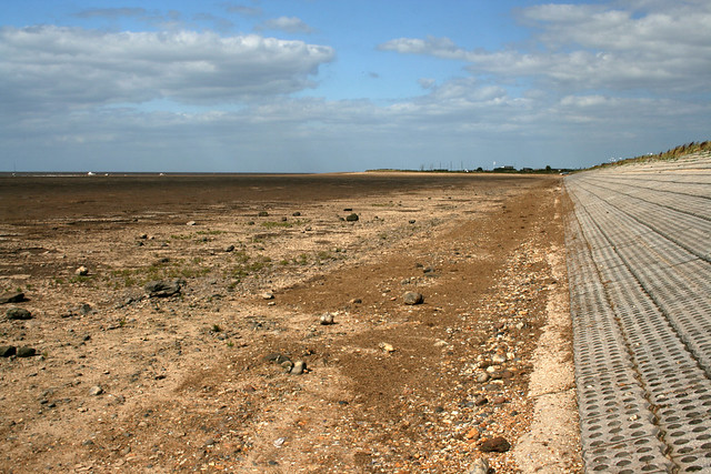
Inland was a view of mostly flat marshes and fields.


I continued along this beach (or the concrete sea wall which briefly appeared), which felt like it was gradually transitioning from beach to marsh until I reached Shepherd’s Port.


It’s a more an extension of Snettisham, really. It’s mostly a small coastal “resort”, by which I mean lots of caravans and chalets, but not much else, though it seemed popular with fisherman.

Sadly the public footpath ends here (or I should say, ended). I continued along the beach however, which was becoming increasingly muddy and marshy.

Behind me there was soon a low sea wall, behind which is a line of chalets. I walked on here briefly, but it was clear I was not welcome.
A sign (actually, a number of identical signs) warned
- No public access along this section of bank.
- This section of bank is on private land.
- This section of the bank is NOT a registered public footpath.
- This section of the bank is NOT a registered public right of way
- This section of the bank is NOT part nor path of the RPSB Reserve
They didn’t (but might as well have) added “Fuck Off” at the end, just to hammer home the point. It was clear I was not welcome here. Rather than walk on the sea wall I simply headed onto the now rather muddy beach. Thankfully, the tide was low and it was dry. In fact it was so dry, the mud had cracked and formed into interesting patterns.

I knew from the map that there was no right of way here, but it is also legal to walk anywhere below the mean high water line, which is what I did. Well mostly, though I did briefly head along the “private” sea wall to get around a few muddy bits when no one was around. Ahead there is an RSPB nature reserve (which I hoped to leave by a public footpath), so I knew if I could get as far as the reserve I’d be able to make further progress.
(As a postscript a protest walk was later held along this walk, part of a campaign to get it registered as a public right of way. This was successful, so it is now a public right of way (and I hope those horrible signs have gone). Ruth has a few photos of this on her blog.)
I’d now reached Snettisham RSPB Reserve. Here there are a series of lakes (I think formed by gravel extraction over the years), lined with paths and bird hides. The first wasn’t overly attractive with what looked like broken up bits of concrete in it.

The reserve is free to enter (though donations are welcome and there is a small parking charge).
I followed the path through the reserve on the coastal side of the lakes. There are several bird hides alongside the lakes. At the one called Rotary Hide the path ahead was now a dead-end. So here I continued past Shore Hide and turned inland at the south edge of the lake and Sanctuty Hide. Time for one last look at the shore before I left it, though it was now really marsh and mud rather than a beach.

Part way along the eastern edge of this lake the public right of way abruptly ended, but a track was marked on the map as continuing inland. About half a mile along this, it suddenly became a public footpath again and then later a public bridleway and it would take me to the A149 at Dersingham. I was just concerned about that half a mile stretch of path that was not marked as a right of way.
My impressions from the earlier sign were that the locals weren’t exactly keen to encourage access, so I was not clear if I’d be able to get through or have to follow the RSPB access road instead. This latter route meant I’d have to head back north for a while and follow roads the rest of the way, so I was hoping not to have to take this route.
As I approached the point where the footpath ended a couple came cycling along this track. They got off and walked on reaching the shingle, so I asked them if they had cycled from the road and if you could get through OK. They told me they had and that it was a path all the way so I’d have no problems. Here they are just leaving.

So here I left the reserve. There were a lot of geese on the reserve though I assume different types of birds use it at different times of the year.

Sadly the reserve got badly damaged in a storm surge a few months later. This left at least one of the hides teetering on the edge of the lake and damaged other hides and the paths. However it was reported earlier this year that a fundrasing campaign had been successful to fund replacement hides.
I followed this to a bridge over a drainage channel (called the Ingon) and then continued on a wide grassy track.

A gravel and concrete track soon joins from the left and the route ahead is then along this.
This was not the most interesting path, a wide concrete track winding between flat fields. I was soon back on the part of the path that was officially a right of way again. This seems like an omission on the map as a public right of way is formed by 20 years of regular use and it seems highly unlikely people had chosen to walk part way along here and turn back again!
The path continued between fields and over the odd drainage channel.

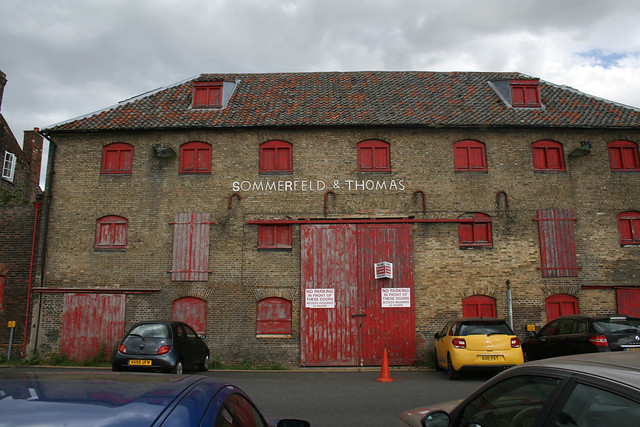
In about a mile and a half I reached the busy A149 Dersingham bypass. I’d travelled along this earlier in the day on the bus. I crossed this and continued ahead on the bridlepath to reach the old railway station. Sadly the tracks have long since gone and the station was closed in 1969. However I was pleased to see that the building survives and seems to have changed very little in the intervening years, though the area formerly occupied by the tracks are now used by a builders merchant.

Dersingham is about 2 miles inland, but it is as close as you can get to the coast here. It was too far to consider getting to Kings Lynn today so I knew I’d need to come back to walk to Kings Lynn next time, so this would be roughly the half way point. Although it was only a little after 3:30pm I therefore decided to end this walk here.
I’d allowed extra time in case the path from the RSPB reserve was not usable and I’d had to divert via their road. As that hadn’t been necessary, I’d made good time. Instead I continued a short distance ahead from the old station along the road ahead and to the main road through the town (now the B1440). From here I took the bus to Kings Lynn.
The bus was a double decker bus, which was largely empty so I sat upstairs to enjoy the views. I don’t think there were ever more than half a dozen passengers, I guess most visitors to Hunstanton prefer the Coasthopper bus which (at the time) ran non-stop between Kings Lynn and Hunstanton via the A149 (whilst this bus diverted via the towns and villages on the way instead).
On reaching Kings Lynn, rather than head straight to the station for the train home I decided to have a bit of a look around the town before I left. It was a pretty and clearly very historic town.


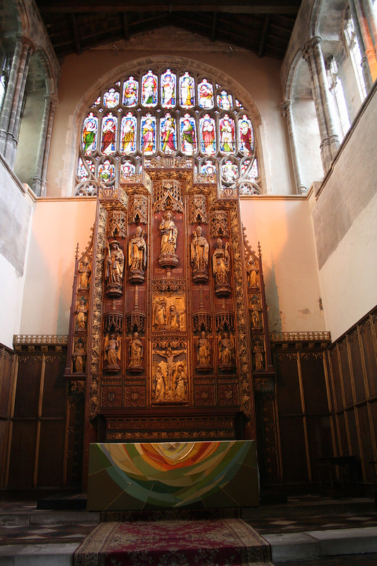
The large church whilst not a cathedral is still almost as big as one (in fact I found it is actually a Minster).

I was pleased to see it was open so I could have a look inside and it was indeed very much like a cathedral inside.

I explored much of the rest of the old town and found that it was an unexpected little gem.


Lots of beautiful old buildings and pretty streets, which seem to be largely undiscovered by visitors.


I also headed down to the quay, where I hoped to reach on my next walk, for a sneak preview!


I was glad I took the time to explore Kings Lynn, as it turned out to be a lovely town. From here I headed to the station for the train home via London.
The first part of this walk was lovely and I loved walking next to the nice beaches at Hunstanton and Heacham. Sadly beyond that the coast had become marsh and with no legal public access, I’d been forced to turn inland over flat farmland to Dersingham, some distance from the coast (a theme that would continue on my next walk). It was not especially interesting after that. Still the RSPB reserve had been nice and at least I’d been able to follow the path from there, as I’d hoped, avoiding the need to double back.
Here are details of the public transport needed for this walk:-
Lynx Bus routes 34, 35 and 36 : Hunstanton – Heacham – Snettisham – Ingoldisthorpe – Dersingham – Kings Lynn. 4 buses per hour Monday – Saturday. 3 buses per hour on Sundays. It takes around 25 minutes to travel between Hunstanton and Dersingham.
Here are the complete set of photos for this walk : Main Link | Slideshow

Kings Lynn is where I started my coastal walk, 8 years ago. I confess I trespassed along the sea wall to Snettisham, but don’t tell anyone 😄
Yes I remember reading about that! I think you also did on the next stretch (which I’ve just posted) to Kings Lynn? I’m afraid given how long it was, I decided against trying to trespass because if I hit a dead-end or got caught it would be a long way to walk back! I was also put off by the thoughts of getting caught up in shooting.
Hi Jon, some invaluable information in this trip report. I’m glad the issue re:the aggressive attitude of some of the chalet owners has been resolved. I had read about previous confrontations with these people. One would have thought the issue would have now been resolved with the plans for the ECP, although I would not hold out much hope. I’ve only been to Kings Lynn once (to the football ground), but hope to have a look around the town.
Just back yesterday from doing the Tamar and Yealm Estuaries.
This part of Norfolk doesn’t have good paths I’m afraid.
Interesting to read your report of the estuaries around the Tamar. Some parts looks absolutely beautiful, but I was put off attempting it due to the amount of road walking (which I can see was a problem). I’m glad to see you made it around safely. I did do a stretch of the Tamar Valley Disocvery trail around Calstock, which was lovely. Maybe one day I’ll do all that walk too!
Pingback: 213 & 214. Kings Lynn to Hunstanton | Round the Island