
June 2007
For this walk I need to cross the river Colne which means taking a long diversion inland to the town of Colchester which is the first bridge across the river. There is, in theory, a ferry further south, from Mersea Island to Brightlingsea but although I found a sign for it, I didn’t find any actual ferry or timetable last time. Fellow coastal walker Ruth did manage to use it on her walk (in the other direction, and not without a few problems on the way) so I do at least know that it exists now.
I decided for this walk to travel by train. To re-start on the Causeway to Mersea Island might be tricky as I was not sure there was any safe parking nearby (the road is too busy to park on, assuming it is even legal to do so). The road also floods at some high tides and I wasn’t sure if that would happen today and if so how far from the causeway it was safe to park – I didn’t want to come back and find my car under water. Since I’d be ending in Colchester where there is a station (the first place I’ve been to with a station for a long time on my coastal walk), it made sense to use the train.
I travelled by train to London Waterloo, then the Waterloo and City Line to Bank and the Central Line from there to Liverpool Street. I needed to buy a ticket from there to Colchester but on using the ticket machine I was presented with two options “Colchester” or “Colchester Town”. I hadn’t realised that Colchester had more than one station. So I opted for “Colchester Town” in the hope that the “Town” suffix indicated that this station was closer to the town centre. The next issue was that I could not see any trains on the departure board going to Colchester Town. So I opted for the Norwich train that was calling at Colchester on the way.
This took around 50 minutes and I found that once I got to Colchester, there was a shuttle train that only runs between Colchester and Colchester Town, so I got that reaching the town station a few minutes later. I managed to find the bus stop for the bus to Mersea Island quite quickly and had about 10 minutes to wait for the bus. (Naturally, it was only later I realised the bus actually started from the main Colchester station). The bus arrived on time but the driver was a little puzzled at my request to get off at the causeway (where there are no buildings near by) and double checked that was really what I meant (it was). He dropped me at the road junction just onto Mersea Island, I’m not sure if that is an official bus stop or not though.
So now I could continue from where I got to last time. It was a lovely early summer day with clear blue skies, plenty of sunshine and quite warm, a perfect day for a coastal walk in fact.
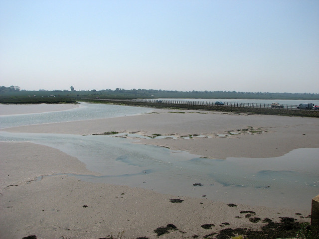
First I re-traced my steps over the Strood. The road was busy, but once on the north side of the causeway I could immediately turn right off the road and onto a footpath that followed the coast north.

I could now stop and take photos, away from the traffic and look back at the causeway. It was clear the tide was low at this time of day.
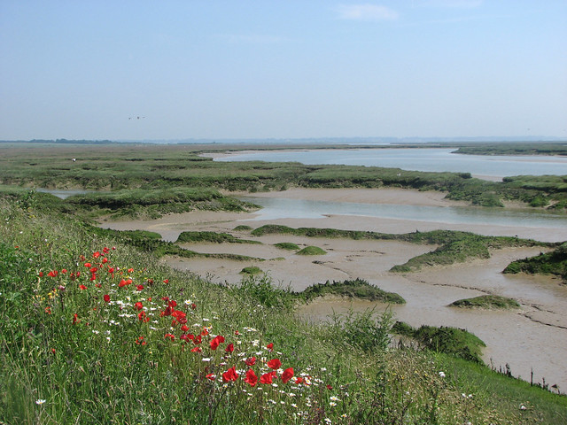
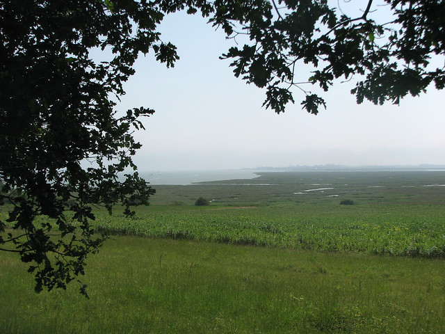
I was now passing an area of marsh land, part of Langenhoehall Marsh I think (don’t ask me to say that). The path was lined with some poppies and some kind of daisy, which added some nice colours to the view.
A short distance along this path I reached Bonner’s Farm which judging by the state of the rusty barn whose roof had mostly collapsed, had seen better days.

As I headed further up the marshes I had an area of water to my right and I was quite surprised how much water there was here given the causeway to Mersea island was mostly dry.

Soon the path turned inland over what was clearly re-claimed land. The map still showed the S-shapes of the water heading further inland, but now dry and you can see it on Google earth, too. However now I was on a raised path on a bank heading back to the main road, probably built when the land was reclaimed.
I decided, just before I reached the road to stop for lunch because it was now gone midday (it had taken me a while to get here) and I knew there was a section of road ahead.
Once I’d eaten I joined the road and turned north. This was a horrible part of the walk because this is a very busy road (being the only road on to Mersea Island) and lacking a pavement. At least there were a few houses and a bit of grass verge in places.

Thankfully I only had to follow the road for around 500 metres where I could turn right off the main road onto Langenhoe Hall Lane. This is a short road, running for only about 300 metres to Langenhoe Hall which despite the grand name seemed to be a fairly ordinary farm.
At the end of the road a track continued more or less ahead, which had a footpath along it. After a further 300 metres or so the footpath turned left off this heading for some trees. There was no path on the ground so I had some difficultly finding the route so just headed over the rough field to the trees. Here I made my way along the edge of the trees into the field ahead and then turned left with the now obvious path.
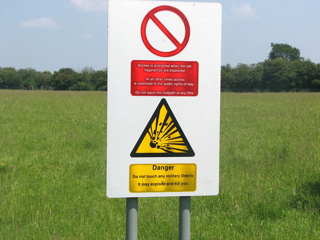
This is as close to the coast as I can get here, because the coast to my right is blocked off the public as it is part of the Fingringhoe Miitary Firing Range. The path I’m on follows the edge of this so I was walking alongside the usual warning notices to my right.
There wasn’t a lot to see in this part of the firing range – it was very flat!

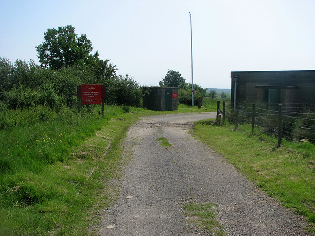
Soon the path reached the end of another road on my left. I couldn’t initially see the route of the onward footpath. Well in fact I’m meant to go through the wooden kissing gate to the left of the gate ahead, it took me a minute to spot the footpath sign.

I also thought from the map that the footpath I was on was outside of the firing range and hence always open, but it seems I was wrong. A sign at the gate warned me “This footpath is closed under range bye-laws when red flags are flying”.
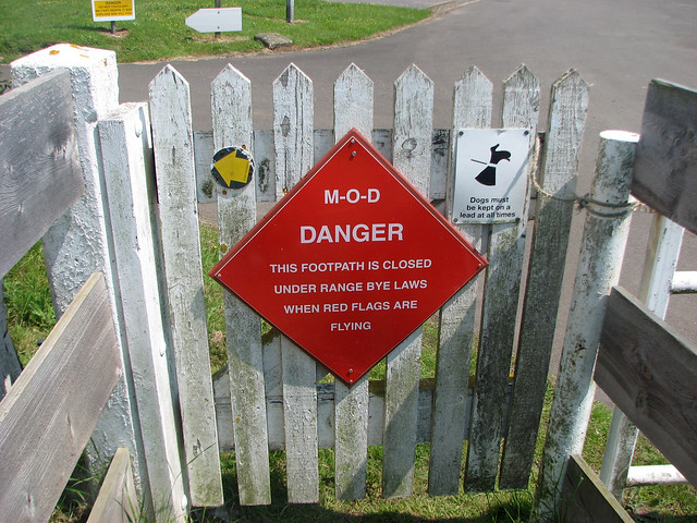
Luckily for me, the red flags were not flying, so I could proceed.
The range turned out to be quite interesting. Zooming in with my camera I could just make out the banks of the river in the distance beyond the range.
But it would be some time before I’d get to the water. Onwards I passed a bin with an unusual sign attached!
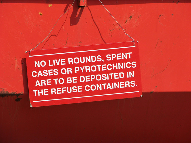
Just past this were a couple of houses which are obviously not real houses but part of the range presumably used for training or shooting from (or at).

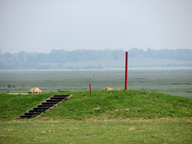
Further along the path was what I presumed to be an observation tower, but none of this was in used today.

At the north edge of the range I passed another flag pole, with the red flag tied up at the bottom of the post, thankfully not needed today. Ahead a sign told me I was now at “Post Wood”. This area of woodland was quite pleasant as it was shady and cool.

My foray into the woods was short lived since I was soon back on the footpath that warned again that the path was closed under range byelaws when the flag is flying.
This stretch ran over the edge of fields at the north end of the range (but just inside it) and passed another road leading into the range.
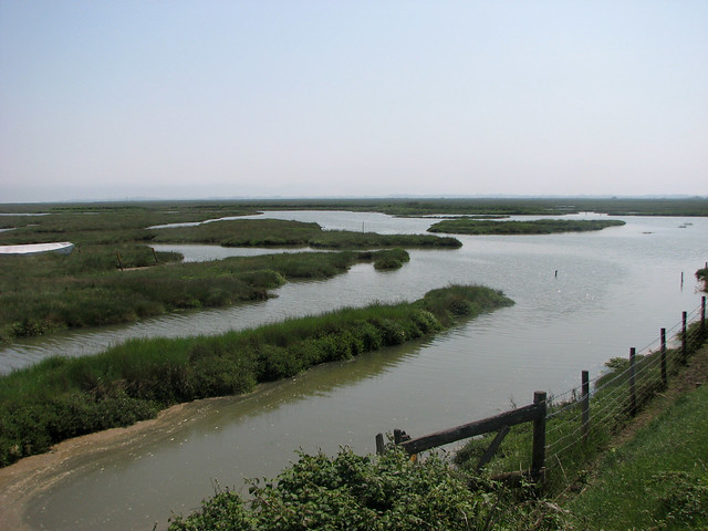
It continued east to reach the north edge of the water at Fingringhoe Marsh. It was nice to see shore again and I could see the tide had come in a long way since I was last next to the water.
Not for long though, as immediately, the path turned left to head north to the road at South Green. Here I turned right and then right again to another road which ended at the start of an area of woodland marked as Fingringhoe Wick on the map.
I had spotted a visitor centre marked on the map ahead and yes, as I hoped, you can enter this area. It is a nature reserve owned by the Essex Wildlife Trust and so when the public road ends, a road continues ahead into the car park of the reserve.
The woodland to my left turned out to be quite hilly, with the trees growing up a steep bank.

Near the south east corner of the reserve I could get a nice view out to the marshland of Geedon Saltings.
I was seeing wildlife, too as I saw several pheasants in the grass beside the path.

On reaching the car park and visitor centre, there was a nice lake on the left surrounded by trees. It was a lovely spot, though there was little wildlife to be seen at this point.

Ahead after the visitor centre there was a bit of a hill from which I could get an even better view over Geedon Saltings and the coast beyond in the range.
Paths continued ahead and soon I could reach the shore beside the Colne Estuary. I was surprised to find there was even a sandy beach here!
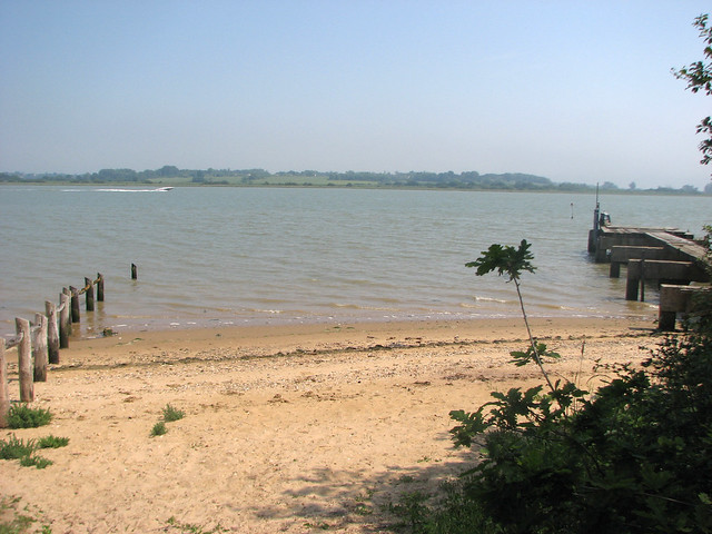
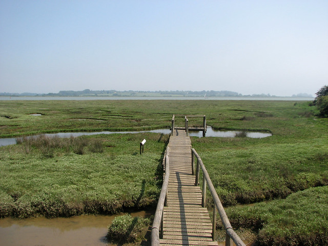
I could continue north along the shore for a short distance, where the beach soon gave way to marsh where a viewing platform had been built. I walked out along it, though there was not much to see in terms of wildlife.

Having reached the end of the nature reserve, sadly there wasn’t a path north along the shore so I had to follow a path within the reserve along it’s north side and back to the road.
Here I could head north on the bridlepath parallel with but around half a mile from the waters edge. On the map I could see some lakes and odd tracks and I soon realised this was an area that was being used for gravel or sand extraction. Ahead the path turned left on a track passing beside a moving conveyor full of sand. It was a slightly surreal sight because there was no one around and no other noise.

The path ended at the end of another road which I followed into the small and isolated village of High Park Corner. At the end of the road I turned right into Ballast Quay Road. This too is a dead-end for cars as it leads to Ballast Quay Farm and a quay where I think the sand extracted from the land is loaded onto boats. It is not a dead-end for those on foot though, as near the end there is a footpath that turns left. I followed this, skirting a somewhat wiffy sewage works and reaching another road, Ferry Road.

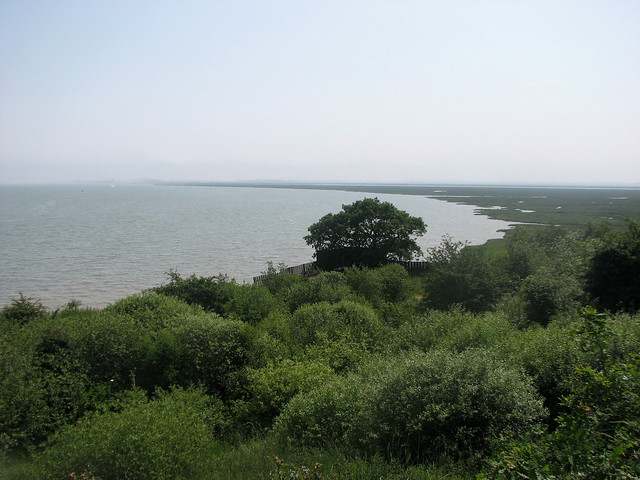
I had heard that there is a ferry between service across the Colne at Wivenhoe, which is now on the other bank opposite, (it is the town you can see above), but I was not sure if it would be running or exactly where from. Since the road I’d now joined was called Ferry Road, I hoped this led to the ferry, as the road ended at the waters edge.
It was only a couple of hundred metres to the waters edge so it seemed worth investigating even if I had to turn back, as it would be nice to finally see the river I’ve been trying to get around.
Wivenhoe, ahead, looked an attractive town with the church tower dominating the scene, it reminded me a little of Maldon, but smaller.
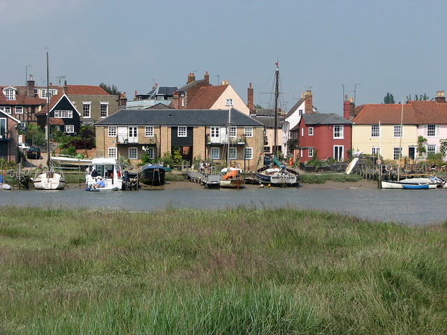

Sadly when I got to the end of the road there was no sign of any ferry. I could see the beer garden of the pub opposite was packed full of happy drinkers sitting in the sun, but I couldn’t get there because there wasn’t a ferry. A bit frustrating – but not unexpected.
At the time there was no timetable online about the ferry, and not much in the way of information either. However it listed as going to Rowhedge, which is not where I was. However there is a website now. This shows the ferry runs roughly 6 days a month from April to October and a few more days a month in July and August. However it is subject to the tides and only runs for around 3 and a half hours around high tide on the days that it does run. What the website does reveal is that the ferry does also come here to Fingringhoe but “only if the water is right” and “passengers wishing to travel to or from here must ask the ferry skipper to land”. So maybe it would have been possible, but this information was not available online at the time that I could find.
So with no sign of the ferry I had to continue on to Colchester. This meant turning back along Ferry Road back to High Park Corner and on along Church Road to the church of Fingringhoe.

I have to head a bit away from the Colne here too because there is another small river to cross, Roman River, and the first bridge is a little over half a mile inland in the village centre.
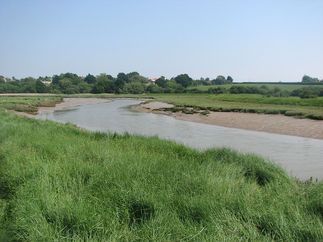
The waters of the river were so calm they were like a mirror.

All these estuaries might be a bit frustrating, but if you catch them in the right conditions like this, when the tide is in, it’s warm, sunny and calm, they are extremely beautiful.
Once over this river there is a footpath right along it’s northern banks, back to the larger Colne estuary. A sign informed me this was the “John Brunning Walk”. I’m not sure who John Brunning is or was I’m afraid.
However his walk turned out to be very pleasant, with nice views of the meandering river.


As I neared the river though I was now rounding some sort of derelict old industrial site, behind fences to my left. I’m not sure what this was used for, but it was all derelict now.
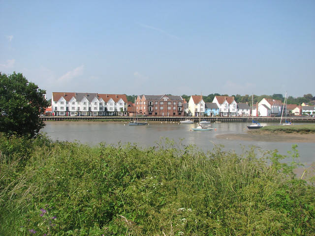
A short distance ahead I was back on the banks of the Colne, now opposite the northern edge of Wivenhoe. This is a very pretty town and I was looking forward to getting there on my next walk.


Even the modern housing to the north of the town had been done in keeping with houses of different styles and colours.

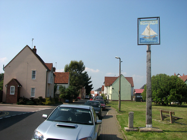
Once around the old industrial area I had reached the water front of Rowhedge, the next village along the estuary. Whilst not quite as pretty as Wivenhoe it was still a pleasant village with many people out taking advantage of the fine weather.

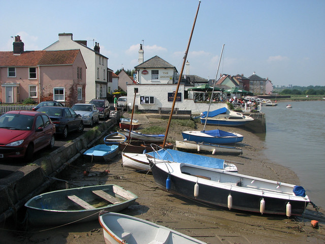
Ahead I came to a pub with a nice beer garden, the Anchor. This time, as I was not driving, I decided to stop for a quick pint in the sunshine. I’d had lunch earlier so I decided against food and just had a nice drink overlooking the Colne.
Suitably refreshed I continued past the village green. Again there were some interesting and attractive buildings here and it was clear the Colne was once a busy commercial waterway, but all I had seen today were leisure craft.

Having followed the road along the waters edge in Rowhedge, when I reached the end of the road there was a footpath right along the banks of the Colne.
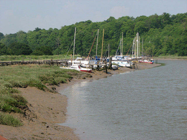
This was really beautiful. On this side of the river were small areas of marshes and the other side of the river was tree-lined. A few people were out boating along the river too, it was a nice scene.

Ahead in the distance though I could see the pylons, cranes and factories ahead- that must be Colchester.

On my left soon were some more lakes. I suspect these are the result of more gravel or sand extraction but now a sign informed me it was “Hythe Lagoons” which seemed a rather grand name for them.
Still the path along the river was lovely and I could see the other side had a busy path with plenty of people walking and cycling past, too. Soon I realised the railway line runs alongside it too, as I saw this train passing by on the other side of the river.

Just ahead, on the other side of the river were some particularly ugly tower blocks – it was clear I was near Colchester now and it did not look as if it was going to be a very pretty place.

I checked the map and concluded these towers were likely part of the University of Essex, it did not look very nice.
As I suspected, my first impressions of Colchester were confirmed as the path headed through a large industrial area. This is part of Hythe, but at least the path continued on the edge of the river rather than forcing me inland to the road. On the other side of the river were some modern flats (or possibly student accommodation), which had a view of all this industry – it made me wonder how the estate agent had described the view!

Beyond these flats were some odd office buildings with raised roof areas at the front, I didn’t like them much.

The path had now ended and I was walking down the dusty road beside the quay, though I did come across this light ship, I do find these ships quite interesting and attractive.

I soon reached the first crossing of the Colne ahead, the A134 Colne Causeway. This is on the edge of a suburb called Hythe. There is a station here too, so I could have ended the walk here but I decided to continue along the road through Hythe to the centre of Colchester as there is a better service and I would have a while to wait from Hythe.
Now passed the industry this part of Hythe was quite pleasant with a few old buildings, mixed in with new. The church was quite pretty, too.


I continued along this main road, the A134 for almost another further mile to reach the large roundabout by Colchester Town station where I ended my walk.

From here I took the shuttle train back to Colchester station (which I later found out locals refer to as “Colchester North”) for the train back to London.
I had an uneventful journey back from there home via London.
Despite the fact much of this walk was not near the coast (and when it was it was a river or estuary rather than sea), I ended up really enjoying this walk. It helped that it was a lovely warm early summers day and this made everything so much more attractive. But there had been a lot of interest too, such as the firing range and the lovely views over to Wivenhoe, which I was looking forward to getting to next time. I also enjoyed Fingringhoe Wick, an unexpected area I could explore, and the waterfront in Rowhedge.
Here are details of the public transport needed for this walk.
First Bus service 67/67A : Colchester – Peldon – The Strood (Mersea causeway) – West Mersea. Twice per hour Monday – Saturday. 8 buses per day on Sundays. It takes around 35 minutes between Colchester and the Mersea causeway.
Here are the complete set of photos for this walk : Main Link | Slideshow

That was very pretty!
Thanks. I’m glad you agree!