
March 2023
Last time I had a lot of problems completing my previous walk (that finished in Dunoon) due to the ferry not running on my 2nd attempt (my first attempt being cancelled due to Covid). When planning my walk around this part of the coast I had originally planned to use the ferry from Dunoon to Gourock to cross from Cowal to Inverclyde and head south from there.
When that ferry got cancelled I had already walked the coast south of Gourock. So as much for reasons of not wasting the day as anything else I decided to walk east from Gourock heading towards Glasgow. In fact my main reason for planning to use the ferry was much of the route of that walk looked difficult and not very pleasant (the A8 and later M8 running right along the south shore of the Clyde) as well as going through some areas I heard could be quite rough, such as Port Glasgow. In fact now I head ended up doing it, it was a lot better than expected.
Studying the map the rest of that part of the coast actually looked pretty nice and by using the ferry I’d be missing a huge chunk of coast. I’ve gone round pretty much every other loch on the west coast of Scotland and I subsequently decided missing out this part would be a real shame and a mistake. So for that reason I’m now walking the long way around instead – hence this walk!
I was on another short weekend trip to Glasgow to walk this part of the coast and had travelled up on Friday evening after work. I was heading home after this walk from Glasgow Airport and so for that reason I was staying in a hotel at Glasgow Airport, specifically the Holiday Inn Express Glasgow Airport. After breakfast and check out I did the now familiar, if not especially pleasant walk from the airport to Paisley Gilmour Street station (this saves a lot of time compared with going into Glasgow and back out).
This time I had more luck with the trains as the train I was planning to catch was running, which is a good start and got me to Gourock on time. Unfortunately the weather forecast for today was grim with rain forecast all day as well as being pretty windy. I was pleased therefore that so far it had been dry.
However I was worried about transport – again. On a previous walk the ferry between Gorouck and Dunoon was cancelled despite being a lovely calm (and dry) day for “severe weather” when it was nothing of the sort. Today on the other hand was closer to that description. Already windy and forecast to get stronger, as well as to be very wet. Therefore when I checked the Caledonian MacBrayne website this morning (the ferry company) I saw that the ferry was running at the time but with the warning that due to the weather it was liable to be suspended at any time.
I had debated whether to go ahead with this walk but I didn’t want to leave a gap and end up having to book another weekend trip (which gets quite expensive) for just one walk. So I decided to risk it. I had to get back to Glasgow Airport again for my flight home later this evening so I had a backup plan. If the ferry was running on the way there I’d go ahead with the walk and if it got suspended during the day I’d hope the car ferry from Hunters Quay would still run (because I’d pass it on the way) and could use that and a bus to get back to Gourock.
Now I had arrived at Gourock I was pleased and pleasantly surprised, given my previous experience, to find the ferry was indeed running, albeit the illuminated sign warned of severe weather and that the ferry may be suspended with no notice. Oh well, might as well take the risk and go for it.
It turns out I suspect the weather had put many off. I was one of just 2 passengers on the ferry! So it was a quiet crossing, taking about 25 minutes.
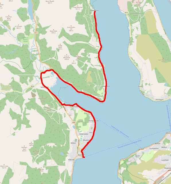
Today is Sunday and my planned start point of this walk, Ardentinny is a tiny place on a narrow unclassified, single track road. I am quite surprised it has a bus service at all. Even more surprising it runs on Sunday! The downside is that there are only 4 buses per day on Sunday. Another problem is the Gorouck to Dunoon ferry only runs hourly on a Sunday (it runs every 30 minutes ever other day of the week). All of this means I have to get to Dunoon 45 minutes before the bus (as the next ferry would be 15 minutes after it). To pass the time I head to shop to get lunch then find a nearby park and then return to the bus stop for “north” buses.
The bus arrives on time and after about ¾ of the way into the journey I am then the only passenger on to Ardentinny. The bus drops me right outside the Ardentinny Hotel, as the bus timetable calls it. To be honest I’m pretty sure it isn’t a hotel any longer.

Actually I am not sure it is even open at all, the signs seem to have all been removed and it doesn’t look very open and the car park is empty.
(I later Google and the website tells me it is under new management and to check the Facebook page for updates, but when I click that I get a message that the page is no longer available, so it doesn’t look good).
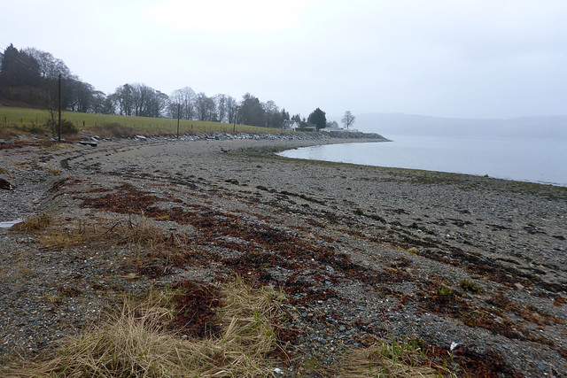
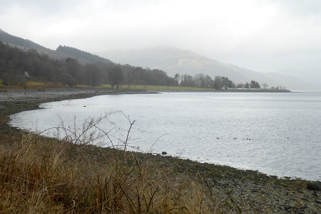
I was keen however to get going. Despite the weather forecast for rain all day it was still dry so I wanted to make the most of it! My route is south along the single-track road beside Loch Long. Ardentinny is a small place and I was soon at the end of the village.

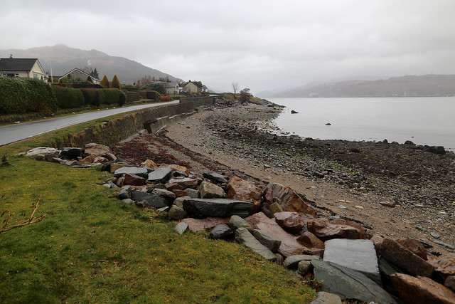
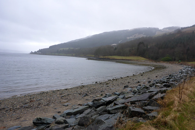
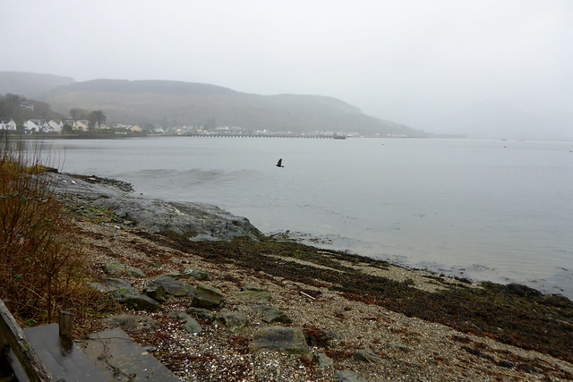
It overlooks Loch Long and there is a small pebble beach. The road climbs up a little and for a while is alongside woodland. Some of this is pine woodland and very thick to the point it almost looks dark in the trees.
The road winds onward right beside the loch and I soon pass a mile stone, one of many along the road with 11 miles to Dunoon. Less than I thought!
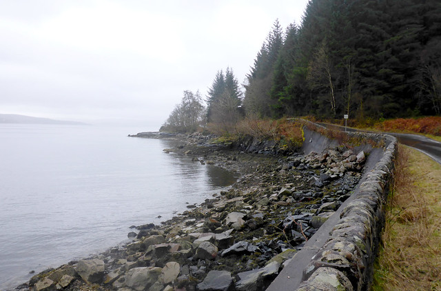
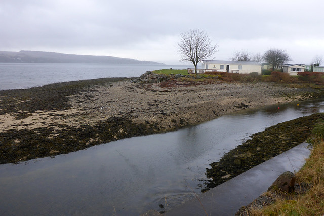
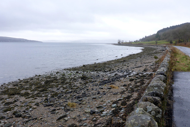
The road here runs right along the coast to the point it’s actually built on a small sea wall with the beach just below. Ahead at Gairletter Point is a small caravan park. It is accessed by a footbridge that looks to be sagging in the middle. As it’s private and very small I stick to the road which soon crosses a little burn.
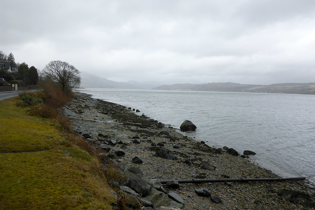
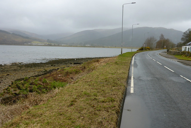
In a mile or so I reach Blairmore and the road now becomes the A880 instead of unclassified. Now there is a white line down the middle and a pavement which makes the walking easier and safer now I don’t have to keep focused so much on the traffic.

Blairmore is a long linear village that stretches for about a mile along this road and near the centre of the village is a pier, bus stop and a shop.

The pier is a Victorian structure that used to be used by the paddle steamers that travelled around these sea lochs and the Firth of Clyde and the Waverley still uses it. It became derelict for a time but was restored in 2005. At some point it has also been used by a Helensburgh to Kilcreggan ferry, but that doesn’t run any more, I think it stopped in about 2010.
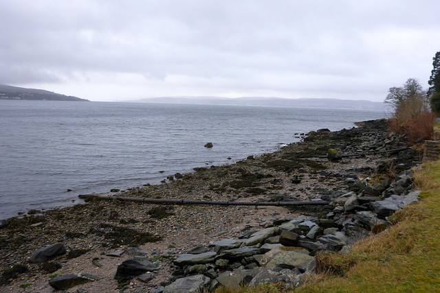

Another mile or so further along this road and I turn the corner into Holy Loch and the village of Strone which largely seems to have merged with Blairmore. There is another old jetty or pier here and I head a bit along it for a better photo.
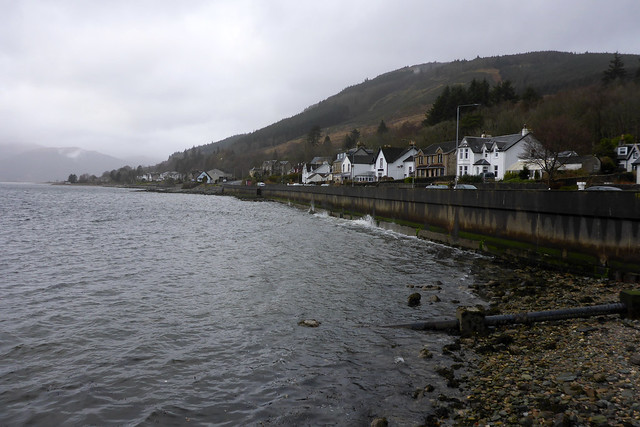
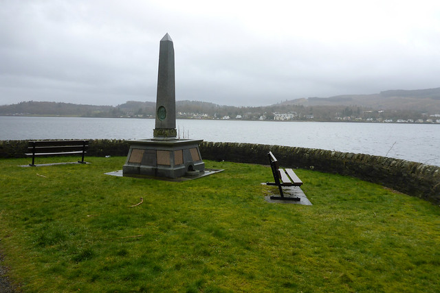
The other side of Holy Loch I can already see the outskirts of Dunoon but I have to go the long way all the way around Holy Loch, but even on this grey gloomy day it’s quite a pretty place. Ahead is a small park on the left and I take the opportunity to leave the road and follow this, since it’s also a bit closer to the sea. There is a memorial at the far end of the park and I continue back to the road.
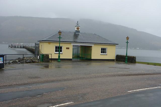
Ahead is another pier, a reminder that boats used to be the main way to travel in this part of Scotland and this one is still in use. For this walk I travelled over on the Gourouck to Dunoon ferry. Until fairly recently this was a car ferry, but these days it’s only a passenger ferry. The old lanes where they used to load the cars are still there at Dunoon (now used for parking) and I gather a new linkspan was even built there for cars but never used. The reason is a competitor set up a service, Western Ferries from Hunters Quay to a bit south of Gourouck and this was I believe cheaper and proved more reliable so much so that CalMac downgraded the Gourouck ferry to passenger only.
One of this companies vehicles ferries seems to be moored at the end of this pier.
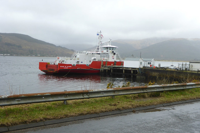
It’s not in service but I’m unclear if it’s here for maintenance or perhaps a reduced service runs on Sunday so one boat isn’t used and so moored up here.
At some point, it’s not really obvious when, I have left Strone and entered Kilmun. This is a very historic village which dates from the 7th Century and I soon pass the village church on the right which has a layby and a structure I must admit I thought was a bus shelter when I passed earlier on the bus but actually gives information about the church.

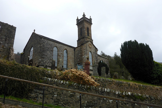
It is open in the summer months (for a fee) and I’ve heard quite interesting but today it’s the 12th March and it doesn’t open until the 1st April so I can’t go inside and take a look.
To my irritation just after this the pavement ends (I had thought it went all the way to Dunoon now but since it switches sides of the road I couldn’t see all the way on the bus from Dunoon) although this turns out to be only for about 1/3 of a mile and then the pavement returns.
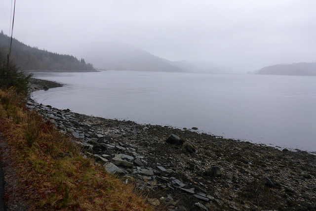
I’m near the top of the loch now which has become muddy and narrow and unfortunately the rain has begun though it seems to rain lightly for about 5 minutes, then heavy for about a minute and then stop! So it’s not too much of a problem.
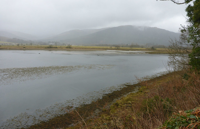

The head of the loch is very pretty and I soon pass a sign that welcomes motorists into the Loch Lomond and Trossachs National Park if they are going the opposite way to me, meaning I have now left the national park, to be honest I hadn’t realised I was even in it until this point!

Near the top of the loch I am expecting to have to keep with the road, but there is an old bridge just before the road junction so I can use this as a bit of a shortcut (it is open to cyclists, too). This avoids the junction with the A815, too though the path soon rejoins the main road which has now become the A815.
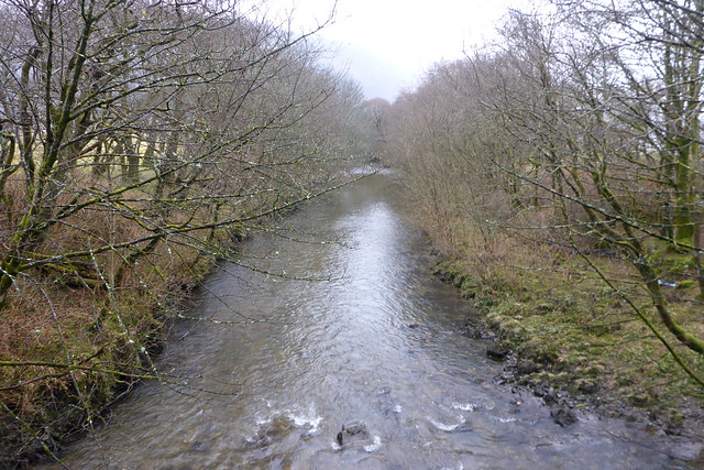
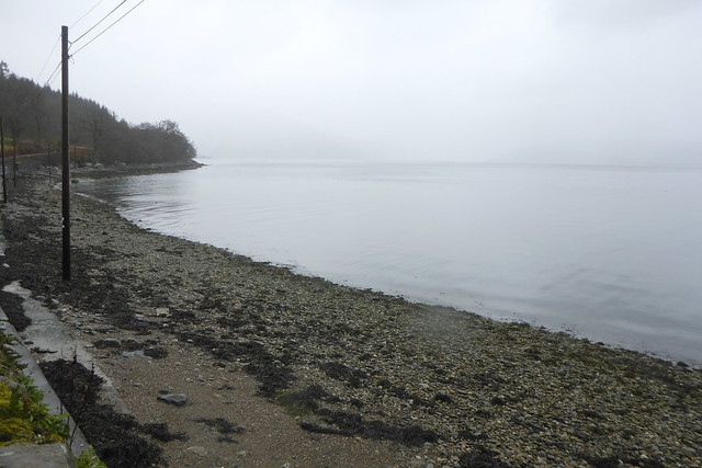
I keep with the road across the Little Eachaig River and round the corner into Sandhaven. Soon I am alongside the loch again and here there is a small picnic area with a car park and some benches. I take advantage of a bench to have my lunch though there are workers from the Council here too doing a litter pick and emptying the bins. I am surprised to see they are working on a Sunday and it’s a shame so much litter had been left for them to pick up.
Back on the road traffic is noticeably busier now, as the A880 I was on before only really serves these few villages, but the A815 is a busier through route. However I only have to follow it for a mile or so until I reach the junction with the A885. This later road acts a sort of bypass of the northern part of Dunoon taking a more direct inland route so most traffic goes that way. I stick with the coastal A815 but the traffic has reduced again now which is nice.
I’m now in Ardnadam which is a small town really and quite pleasant but unfortunately the same cannot be said for the weather which has now turned to rain and is beginning to get quite heavy. I soon pass the pier (most places along the coast near Glasgow seem to have one) but sadly other than the shore end building which looks to be in good condition, the rest is derelict and closed off.
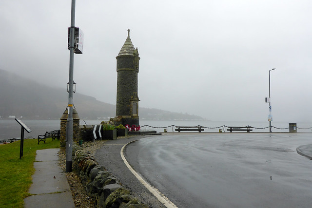
Keeping with the road I soon come to Lazaretto Point which has a very grand war memorial, more a tower really. I did wonder if it was also used as a navigation aid for shipping.

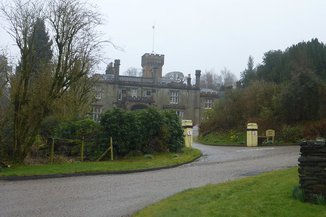
On my right I am soon passing the grand Hafton Castle which was obviously once a grand estate. These days I think the main building is used as wedding and events venue I believe whilst the grounds seem to be a large caravan park.
At the end of the estate the road enters Hunters Quay, really a suburb of Dunoon. Sadly as I approach the weather gets worse and the rain heavier to the point I can barely see across the loch any more.
I soon reach the car ferry terminal and a ferry is just arriving. Here I stop to check my phone (which is buried in my bag) because I want to see if the passenger ferry to Gourock is still running. If it isn’t I will need to use this ferry to get back instead and needed to be here by the latest of 3pm if that is the case in order to be able to catch a bus to Gourock on the other side for the train I need to catch in order to get to the airport in time for my flight.
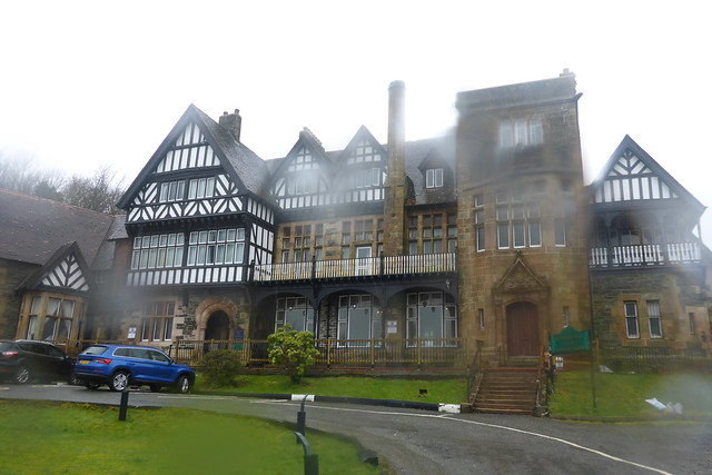
Fortunately the CalMac website has the same warning it had this morning but doesn’t indicate any sailings have actually been cancelled and the ferry seems to still be running, so I press on, admiring a rather grand hotel on my right. I am glad because otherwise I’d end up with a mile or so gap between Hunters Quay and Dunoon.
My feet are hurting a bit now as I had to make an emergency change of shoes when leaving home on Friday morning when I spotted the sole was coming off so I swapped to trainers and they have let the water in with the result it feels like I am getting blisters, so I’m glad I’ve nearly finished the walk. (Yes I should have planned better!).
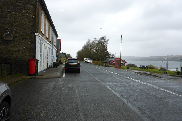
At Kirn I round the corner and can see the parts of Dunoon I recognise. I quite like Dunoon. It has the air of a resort about it even though there isn’t a beach, with palm trees even in places and some large buildings that I suspect were once mostly hotels.

Unfortunately at this point the rain is of the sort that is so heavy it bounces back off the road so that is the end of the photos for today.
I head along the road and reach the ferry 20 minutes before the next sailing. At least there is a heated and dry waiting room (portacabin, really) I can go in and begin to dry off (by dripping all over the floor!). Fortunately the ferry is still running so I can take that to Gourouck. From there the train on to Paisley Gilmour Street station then a walk from there to Glasgow Airport. I prefer to walk from the station to the airport (it takes half an hour) because the bus is very slow and by the time I have waited for it, it will take longer than walking. I feared that would mean getting very wet again just as I have been able to spend the last hour and a bit drying off! I am pleased to find that again despite the forecast the rain has stopped so I can walk as I prefer. I have pretty much dried out by the time I reach the airport.
For this trip I ended up having to travel from Stansted airport on EasyJet as it was now the only suitably timed flight I could catch after work on Friday night, which is a pain as it’s the furthest “London” airport from home and I have to travel via central London on the train to get there, but it does at least have a station. My flight is late though only about half an hour in the end so I arrive in plenty of time before the last trains.
I knew the weather would be poor today but relieved it was actually far better than forecast and I only had rain for the last hour or so of the walk. It was almost all on roads, a bit hard on the feet but at least these were right by the coast the whole way so I had some lovely views and there wasn’t too much traffic most of the way. I am glad I made the decision to include this part of the coast. Perhaps that previous ferry cancellation was a blessing in disguise!
Here are details of the public transport needed for this walk:-
West Coast Motors route 489 : Glenfinart – Ardentinny – Blairmore – Strone Pier – Kilmun Pier – Sandbank – Hunter’s Quay – Dunoon – Innellan – Toward (Lighthouse) – Toward Castle. Approximately hourly Monday – Saturday. 4 buses per day on Sunday. It takes around 35 minutes to travel between Ardentinny and Dunoon.
Here are the complete set of photos for this walk : Main Link.
Here is a map of the walk:-

Looks like a straightforward walk down a lovely loch. Shame about the weather.
Yes a nice easy one this one, both in terms of route and transport, which made things easy.
Hi Jon, I quite enjoyed walking the Clyde Sea Lochs. The Church at Kilmun looked fascinating, although I could not gain access, I spent about 30 minutes checking out the graveyard, which contains some amazing stones and a Morte Safe! I would have spent longer, but this section from Lochgoilhead to Dunoon was a 27 mile walk and one of the few walks I actually finished in the dark!
Yes I enjoyed all the lochs too, that was why I am really glad I abandoned my original plan of using the Dunoon to Gourock ferry and decided to walk around instead. It was a much nicer part of the coast than I expected.
You certainly did a long day on this one. I split into two walks as you have seen. I suppose at least if you finish in the dark you have street lights which is probably quite atmospheric, though.
I’m experiencing the joys of Calmac ferries right now. Something of an epic journey just to get on Islay. Tricky times ahead! 🙄
Oh dear! Still I look forward to reading about it, I bet you took some wonderful photos you always do.
I quite liked Dunoon too. Shame you didn’t get the best weather for it.
I’ve also been frustrated by ferry cancellations in weather that didn’t seem that bad. I was told that it’s not so much the conditions on the water – ferries can generally cope with worse waves than the passengers are comfortable with – as those around where it has to dock. If it can’t dock safely because it’d be washed into the pier/quayside/slipway, then it gets cancelled.