
July 2023
This was my first walk of this trip so I had started the day at home making an early start in order to catch a 09:40am flight from London Heathrow to Glasgow which unusually (as it was British Airways) didn’t get rescheduled and ran broadly to time. Here I had booked a hire car. Fortunately this time I was given the car I had actually booked (a petrol Fiat 500) and not an electric car, as had happened on my previous trip (for this reason I absolutely avoided booking with Hertz again and used Budget this time).
Other than the usual seemingly permanent roadworks at the “rest and be thankful” where I had about a 15 minute queue in the temporary traffic lights (perhaps it is so called because you get plenty of time to rest waiting for the lights to change!) the journey went fairly well.
Unusually for a fairly rural area there is a direct bus between Colintraive and Tighnabruaich and it runs several times a day. I parked up in the public road-side parking outside the hotel I would be staying at in Tighnabruaich as it was too early to check in yet. The bus timetable showed I actually only had about 20 minutes to wait for a bus from Tighnabruaich to Colintraive so I decided to wait for that, so I could then walk back and not have to worry about arriving at a specific time to catch a bus.
This meant I had time to faff about and sort out the stuff I’d need in my rucksack for today’s walk and take out the rest of my luggage needed for the rest of the trip that I didn’t need for the walk, to save carrying it all about (I’m too stingy to pay extra for checked in luggage on the flight so have to make do with the free hand luggage allowance).
Then I headed across the road to the bus stop because it was directly outside the hotel I would be staying at. By the time I had finished faffing another lady had arrived waiting for the bus. This is fairly unusual in my experience in rural parts of Scotland, I am usually the only passenger getting on somewhere!
I never find her name so I shall call her Mrs Grumpy (sorry), for reasons that will probably quickly become apparent. She soon asked me if I was waiting for the bus to Dunoon. I said yes I was waiting for the bus but was going to Colintraive not Dunoon (which is the end of the route). Of course she then assumed I was going to the Isle of Bute (as Colintraive is one of the ferry ports for the Isle of Bute) so I said no I was just going for a walk from there which probably confused things. So I asked if she was going to Dunoon and she told me she was. Then went on to tell me “Oh it’s a terrible place now. All the shops have closed. There is nothing there”. Of course this isn’t quite true. I’m sure some of the shops have closed but certainly not all of them!
She went on to tell me her age and how long she had lived in Tighnabruaich and that she was going to Dunoon in order to catch the ferry to Gourock. “Oh it’s a terrible thing” she tells me. “Like a washing machine, it throws you about all over the place”. (I haven’t found the ride too bad myself I mean it goes over the sea, so it’s never going to be completely flat). I asked if she was going on from Gourock (where the ferry docks). “Oh yes then I’m going to catch a bus to Glasgow” she told me. I said I hoped she enjoyed it but “oh no it’s a terrible place, there is so much crime, it’s nothing like it used to be, it’s not safe now”. She went on and told me she was going to visit a friend and “I hope I don’t have to leave her house once I get there until I come home again”. Well I tried to make polite conversation but I admit I was finding it hard!
Fortunately at this point I spotted the bus arriving and flagged it down. This didn’t go down well either. The bus was a small Mercedes Sprinter type thing. Not the most comfortable perhaps (it’s basically a van with seats). I was just glad to see it arrive, I wasn’t going to be on it for long anyway, but Mrs Grumpy exclaimed “Oh god is that the bus? It looks more like a bloody ice cream van”. It took a lot of effort not to burst out laughing at that point! Although I had to agree she had a point – it did look a bit like an ice cream van, being painted a mixture of red and cream. Fortunately she found another friend of hers already on the bus so sat with her for a chat so I had a break!
The road we were on will be my route for about half the walk so I got a bit of a sneak preview and the road into Tighnabruaich is particularly scenic, with a view point at the highest part.
Soon we arrived at Colintraive which has a ferry over to the Isle of Bute (though it’s not the only ferry to serve the island). I think the service is quite frequent and the boat was already in when I arrived.
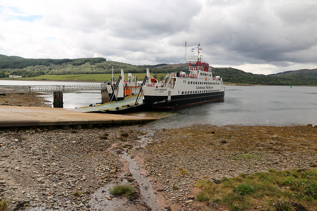
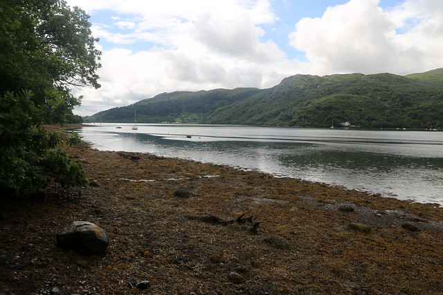
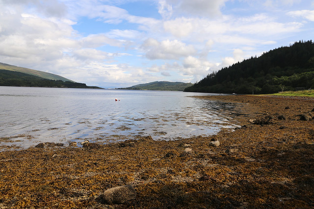
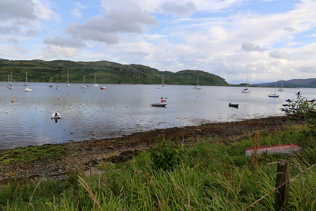
Since I had had to travel here from home in Surrey I was quite hungry by this point after several hours of travelling so I decided first to have lunch on the beach beside the ferry port before setting off since the pebbles at the back of the beach were dry.
The ferry was larger than I was expecting and the route seems quite busy. The first mile or so of my walk was back along the A886. This ends at Colintraive except it doesn’t. By which I mean the road beyond the ferry on the mainland ceases to be the A886 but the A886 itself carries on onto the Isle of Bute which is unusual in my experience.
Fortunately because there is not a lot beyond the ferry traffic is quiet and mostly comes in bursts when a ferry arrives. In any case there was the great luxury of a pavement! Just past the ferry was a monument which I learnt was the McKirdy Monument and was so named after twins who were both injured and died within six weeks of each other during World War I. A sad place although I noticed it did have a bench where I could have sat and had lunch (it would have been more comfortable than the beach) if I had known it existed. Oh well, too late now.

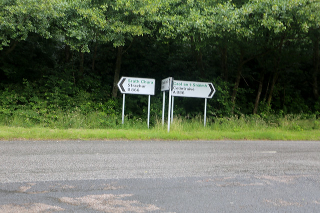
The pavement continued until my planned turn off onto the B866 which then is the more coastal road. I suspect at one time the B866 was the A886 because there was a brief bit of old road that linked them (now part of the pavement, really). The B866 runs as a roughly 2 mile “loop” off the A886, re-joining it later but providing a more coastal route, so that was where I was going.
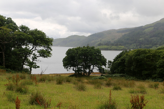
It passed a couple of large houses and then in and out of woodland with intermittent views of Isle of Bute, Kyle of Bute and later a loch which seems confused as to it’s name as the Ordnance Survey map shows it as “Loch Riddon or Loch Ruel”. So I’m not really clear what to call it. I shall call it “Loch R” to avoid causing any offence by using the “wrong” name.


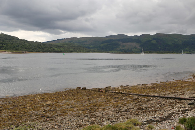
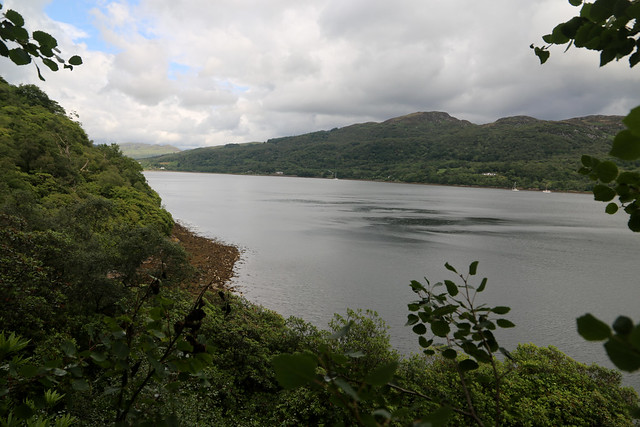
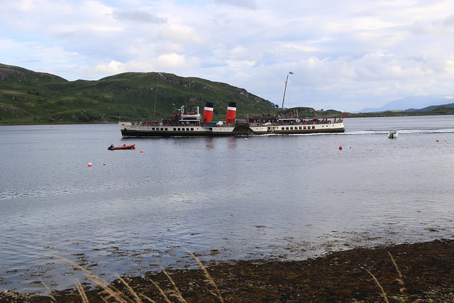
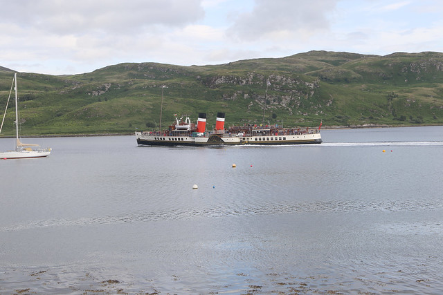
Soon I heard a sound and spotted a boat in the waters of the Kyle of Bute. I took a closer look. Yes … I recognise that ship. It’s the paddle steamer Waverley. (Just visible near the centre of the photo below).

I had travelled on Waverley earlier in the year (from Clevedon to Ilfracombe) and was due to do so again later in the year from London to Southend. Waverley spends much of the year in her home waters of the Clyde and sea lochs around it and a quick check on my phone of the Waverley website confirmed she was running a “Round the Isle of Bute” trip this afternoon and would be docking at Tighnabruaich later. I had no idea Waverley was operating in the area and it was nice to see this historic ship again, this time in her home waters (she is the last remaining ocean going paddle steamer in the world).
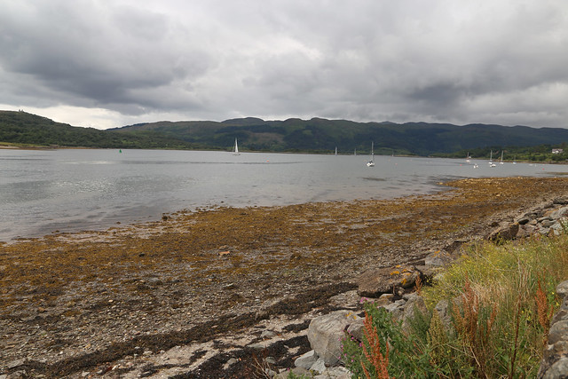
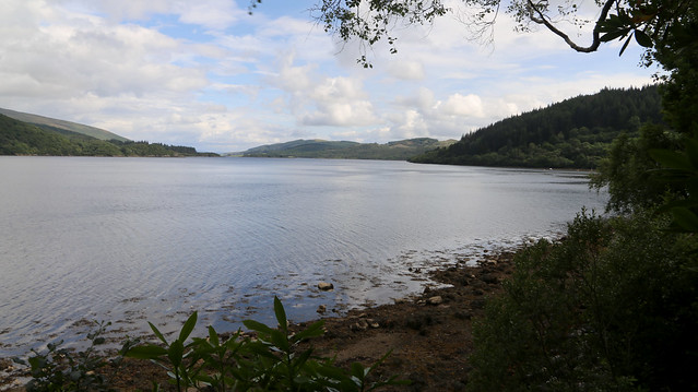
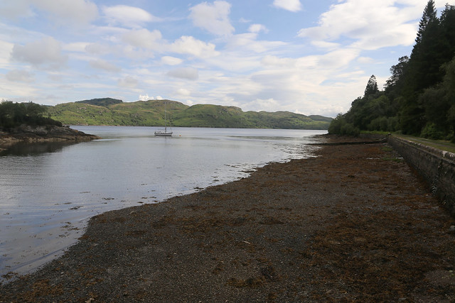
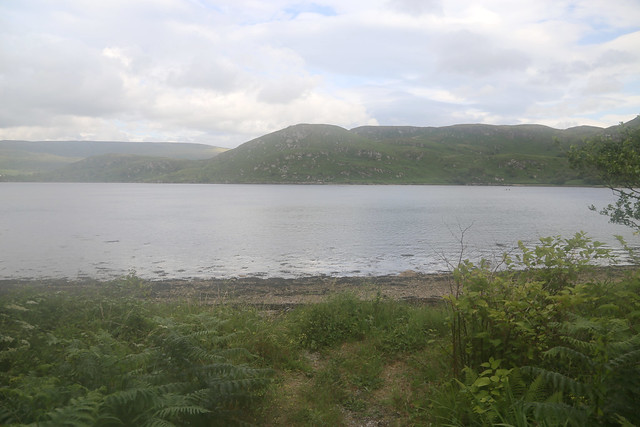
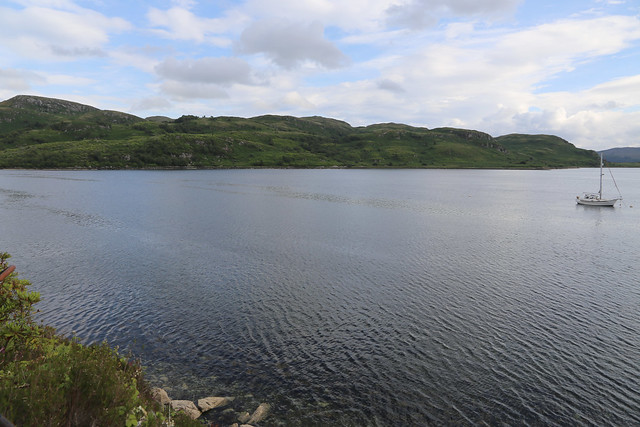
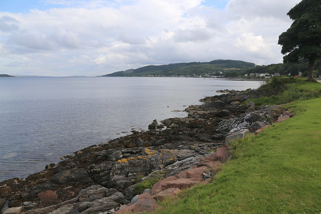
After a while the B866 runs right along the shores of the loch so I can drop down onto the beach for a brief break. It is a beautiful spot and although not sunny it is at least dry and with a few patches of blue sky around.
Sadly, it is soon back to the busier A886 for the next 2 1/2 miles or so and by now the pavement has ended so it’s a bit of grass-verge hopping ahead.
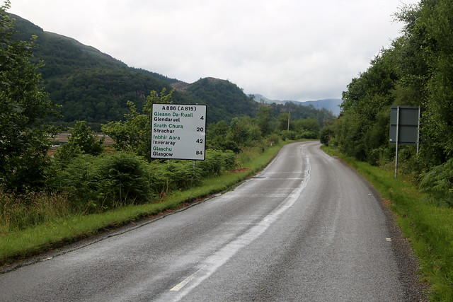
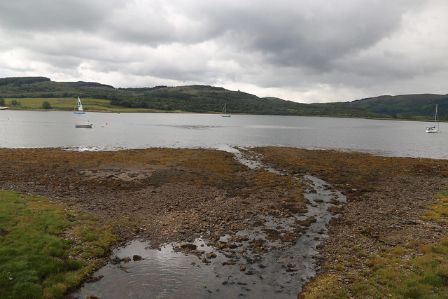
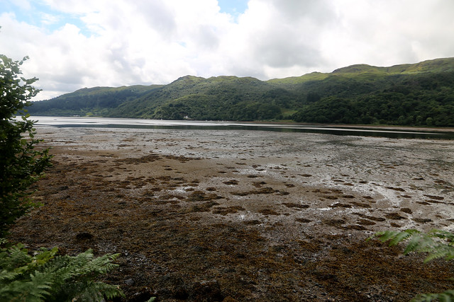
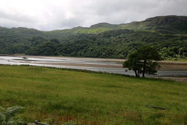
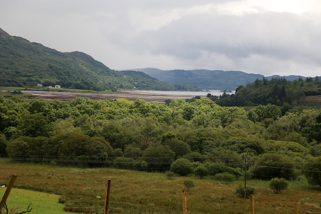
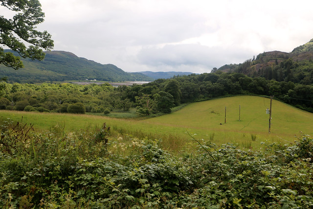
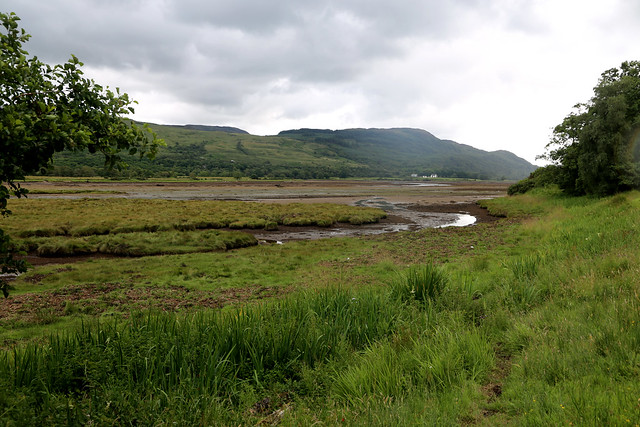
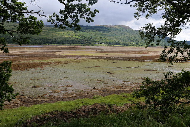
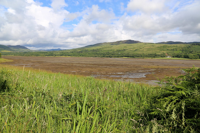
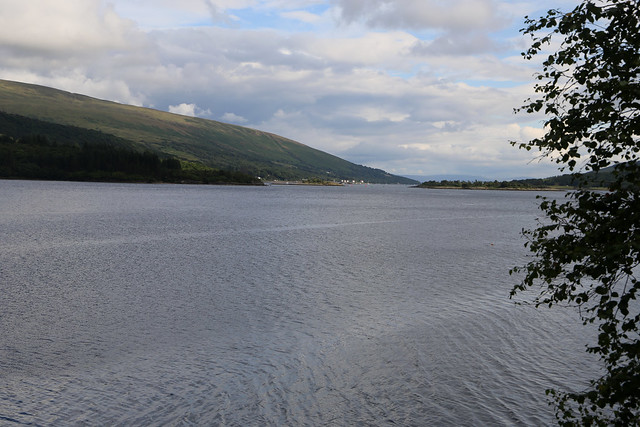
42 miles from Inveraray, according to the road sign which is further than I expected. At times the road climbs a little and gaps in the trees give me fine views of the marshy waters as the Kyle of Bute becomes Loch R. The tide is out, so much of it is mud flats.

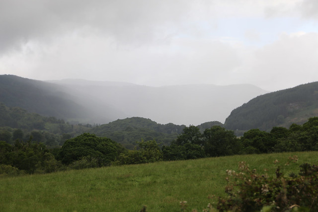
As I near the road junction the road climbs higher and I can see further inland where it looks like there is a heavy rain shower. Fortunately, the worst of it misses me, with just a few spots of drizzle.
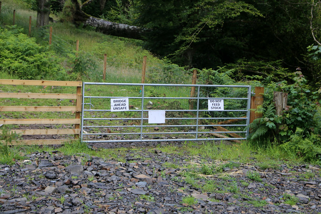
As I near the junction with the A886 and A8003 there is a track beside the road with warning sign “Bridge Ahead Unsafe”. I usually take such things with a pinch of salt, they often seem to be more designed to deter walkers than be factual. Fortunately I’m not going that way so it doesn’t matter today.
I soon reach the junction and can turn left onto the quieter A8003.
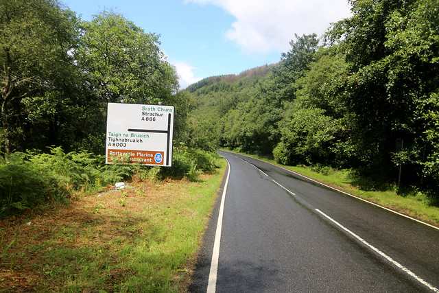
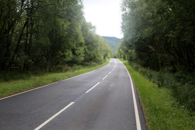
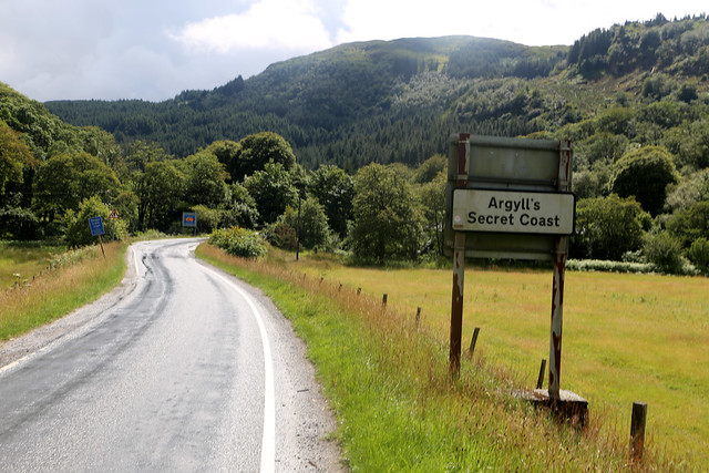
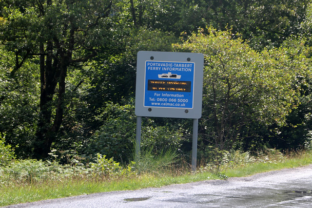
Despite the A-road designation it is mostly single track with passing places and so traffic is not that busy but there is the ferry to Portavadie ahead with an illuminated sign giving details of the next ferry and another describing this as “Argyll’s Secret Coast”. Really? What’s secret about it I mean the road is on the map so it is hardly hard to find.
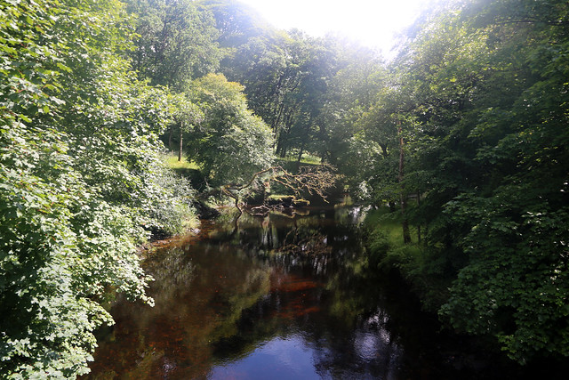
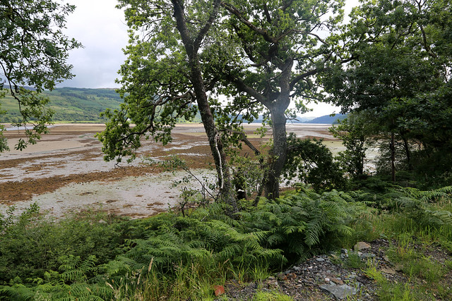
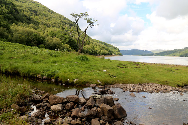
The road soon crosses a river called Cuil Uinseann. It is very beautiful with some sunshine casting rays through the trees to the water, a lovely peaceful spot.
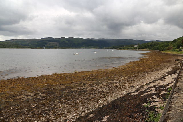
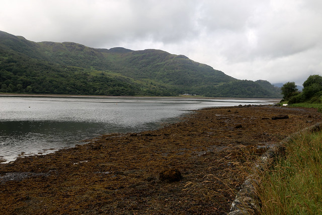
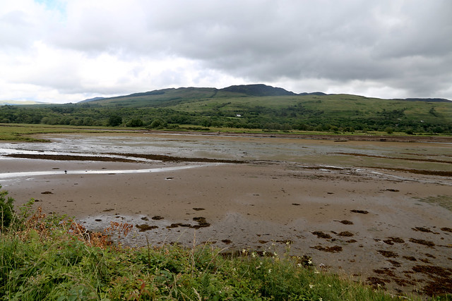
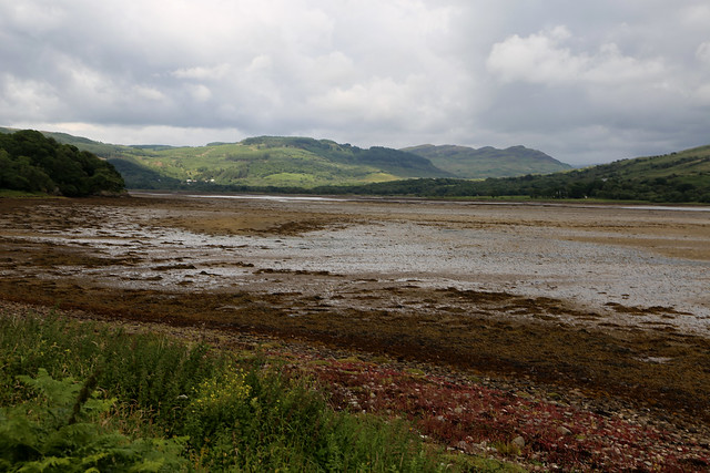
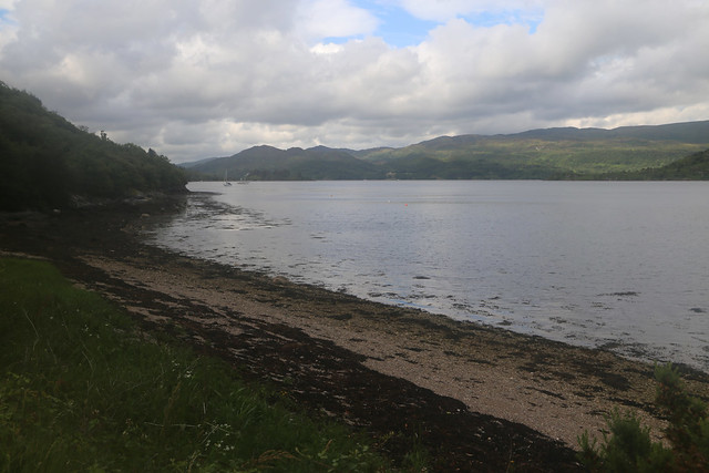
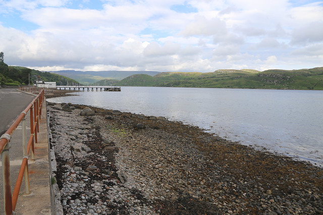
The road climbs a little through woodland and then descends back to the marshy water at the head of Loch R. As I head south the water gets wider and soon the road is right beside it again.
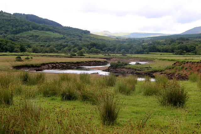
The tide was low earlier but it seems even lower now as it is almost entirely mud rather than water.

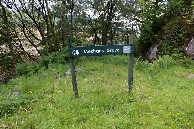
I pass the entrance to an area of woodland that the sign tells me is called Mechans Grave. The Ordnance Survey map on the other hand tells me it’s called “Meckan’s Grave” (different spelling). Either way there doesn’t seem to be a sign explaining this name.
The weather is improving all the time and soon it is mostly sunshine. This makes everything look so much prettier and it’s a lovely area.
Soon I can leave the A8003 and follow a more minor road that runs closer to the shore. This runs for about a mile and is, for motorists, a dead end but the map shows that a footpath, part of the longer distance Cowal Way continues from the end of the road to the end of another road that leads into to Tighnabruaich and I wonder if the two roads were joined in the past. Either way I’m pleased at the prospect of a proper path instead of roads.
This is a very pleasant section along this very minor road because there is no traffic it only serves at most half a dozen properties. Soon I am at the end of the road, with a rather grand property ahead with an impressive tower.
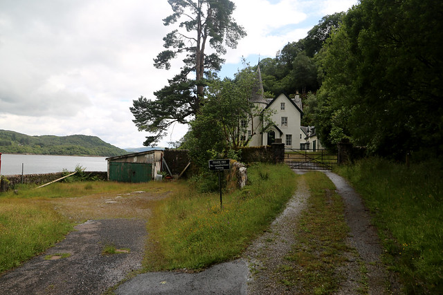
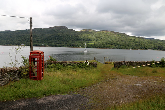
Craig Lodge, according to my map and to my surprise there is even a phone box here although I am not sure it still has a phone in it.
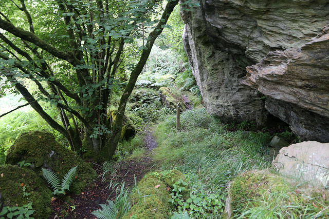
Unfortunately it has all the hall marks of being a dead end and the various private notices don’t exactly welcome visitors, but then I spot the onwards footpath sign under the trees to the right of the driveway. Ah the path. Good. I was beginning to fear it might not exist.
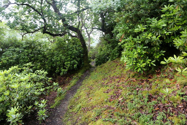
The path is quite narrow and begins to climb steeply and heads away from the house, up and up. There is a lot of rhododendron growing here, a bit out of control which limits the views a little and narrows the path. However board walks have been provided in places, which helps. In fact I quickly learn that the only flat parts of this path are the boardwalks!
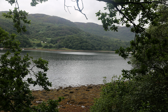
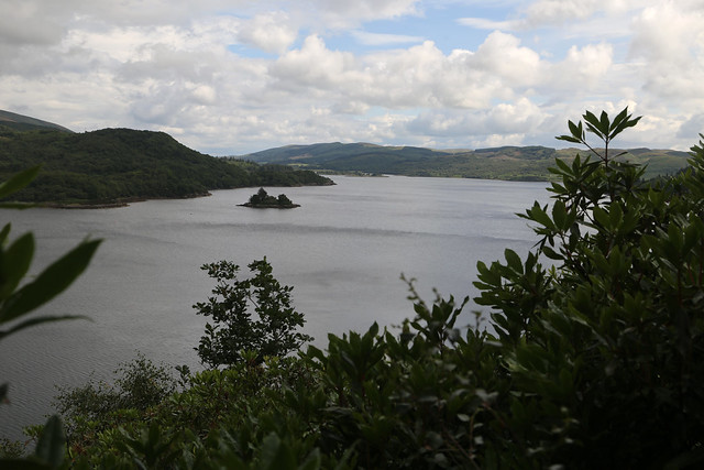
It is a long way up but I am rewarded for my efforts with this stunning view over Loch R and the Kyle of Bute.
Unfortunately as soon as I reach the top, it’s back down and in places the path emerges onto the shore. In truth, it’s not really a path at all for much of it’s length. More rock climbing up and down. Can you spot the path on either the next two photos?

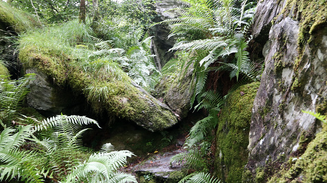
It is there – but it’s hard to spot, the sort of path that it keeps looking like you come to a dead end only to spot an onward route at the last minute, but it’s more rock climbing and dodging through thick undergrowth.
I have my camera (a Canon EOS 6D) around my neck, which turns out to be a mistake. It was, when I bought it, supposed to be “weather resistant” (I think this means it is meant to withstand rain, but not a fall into a lake, for instance), but that seems to have long since stopped being the case. Now if it gets any water on for more than a few minutes or in the rain for more than a few minutes it starts to misbehave as the water presumably gets inside and interferes with the electronics. It’s not raining but all the thick bushes are very wet with dew and water from the earlier shower and this has got onto the camera as I brush past. For this reason some of the next few photos are in a different aspect ratio (more “wide screen”) as some times it decides to switch itself to video mode and refuse to switch back.
Anyway despite the path being quite difficult it is beautiful and I am quite enjoying the challenging route. I am glad I am not pressed for time and having to hurry for a bus though as I can take my time (necessary in places) and enjoy it.
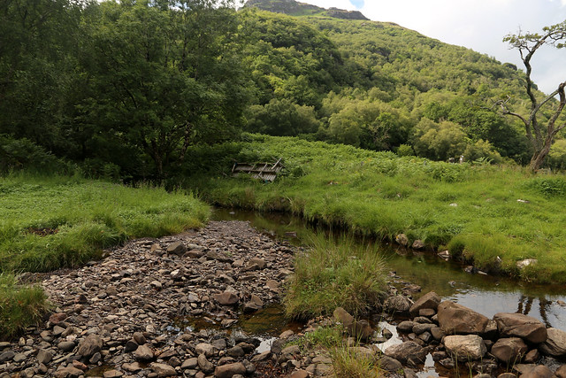
Part way along the path comes back down to the shore at a burn. I have to jump across this and later I spot the remains of a footbridge now turned upside down on the grass and bracken. I presume washed away in a storm at some point.
I soon come to a choice of routes, which is unexpected (as it’s not marked on the map). (Sorry the camera auto focus had stopped working at this point too and I hadn’t noticed, so it is a very blurred picture).
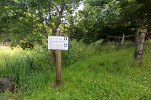
A low tide route and a high tide route. Well I know the tide seems far out, so I stick with the low tide route.
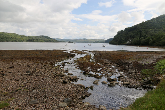
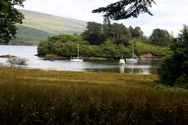
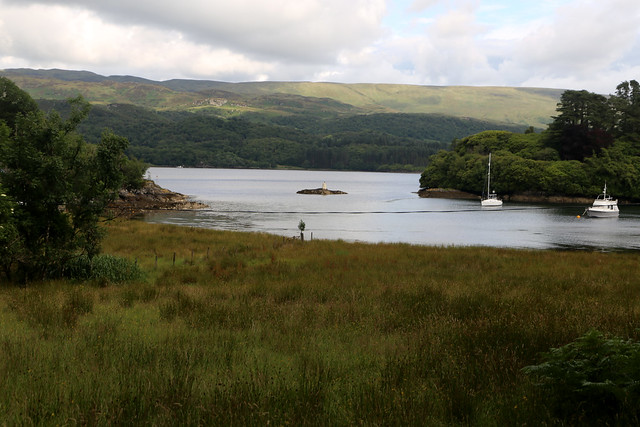
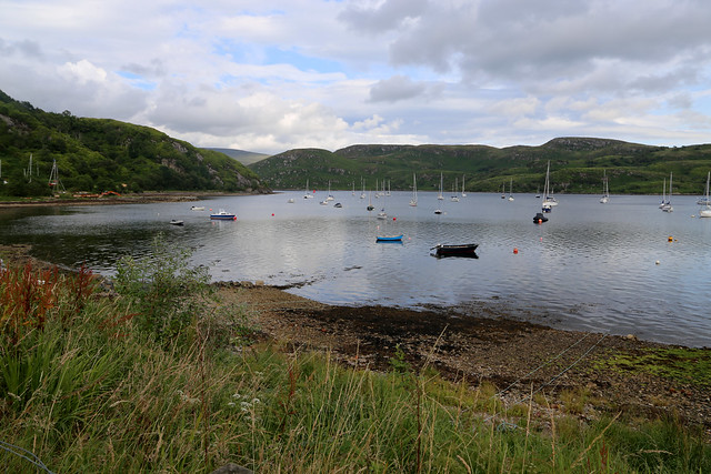
This follows the shore with a brief climb up into woodland again and comes down to pretty Cladh Harbour. A few boats are moored here and I wonder if they belong to nearby residents who use them rather than the road, owing to there not being any road.
From here the path becomes much easier. Perhaps an old road it is mostly a wide track, sometime grass, sometimes gravel or tarmac.
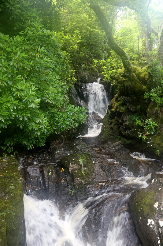
There is a small waterfall beside the track at one point which is pretty.
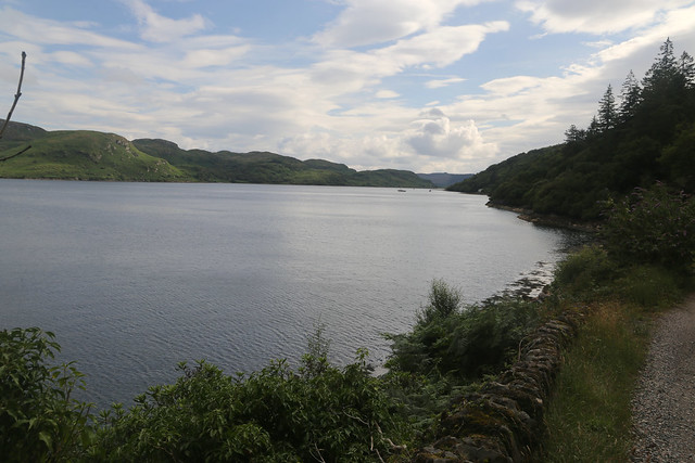
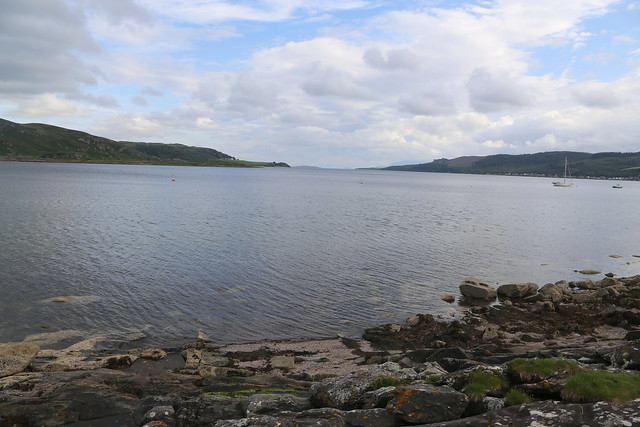
I have lovely views of the loch and I can enjoy them more now I don’t have to watch every footstep. Unfortunately the damp in my camera has now turned to mistiness on the lens, sorry about that.
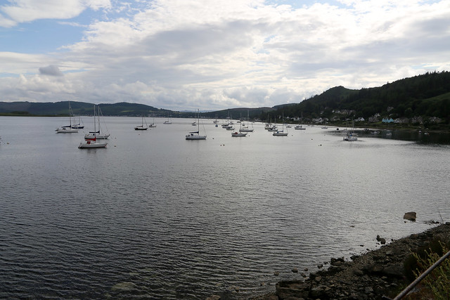
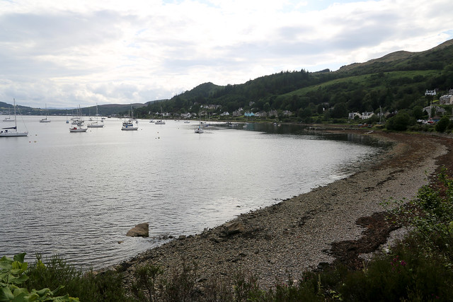
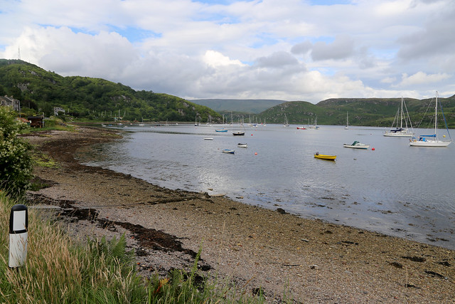
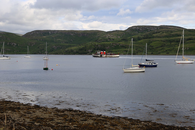
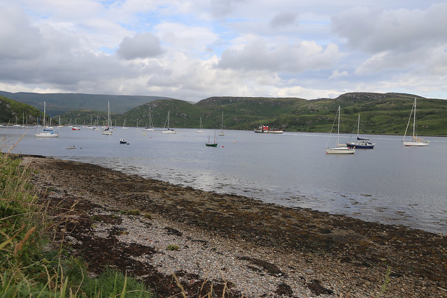
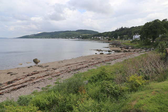
I can soon see the many boats moored up in the loch ahead, a sign I am approaching a town, in this case Tighnabruaich.
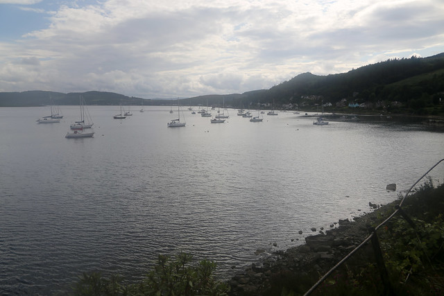
It looks a pretty place even if I have no idea how to say it. Later when I checked in to the hotel I did ask the member of staff at the reception desk at the hotel who told me how to say it – then I more or less instantly forgot. Oops.
The track, now partly cut into the cliff face soon rounds the corner and becomes the end of a public road again.
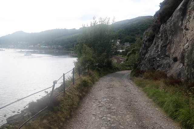
Progress is easier and the mistiness on my camera lens seems to have gone now which helps with the photos.
Traffic is light as this is a dead end road but it builds a little as I progress along it.

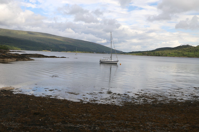
Soon I spot the familiar sight of Waverley again in the loch ahead, as she is due to dock at Tighnabruaich pier about now.
She departs the pier before I get there but this gives me the opportunity to see the boat moving at fairly close quarters because of course when you are on board you don’t see much of the boat itself, a lovely sight. (I have already booked another trip on this ship for 2024 this time along the Gower and Pembrokeshire coast which I am looking forward to).

She soon moves closer to the coast of the Isle of Bute and heads around the north coast of the island again. I think she is heading back to somewhere near the Clyde now (Gourock? I can’t remember exactly and didn’t take a note).
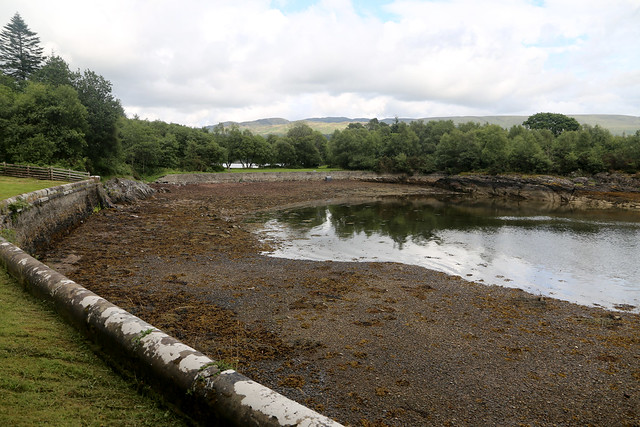
When Waverley disappears around the corner I continue along the road to soon reach the pier. This was a hive of activity 15 minutes ago when Waverley docked. Now all is quiet.
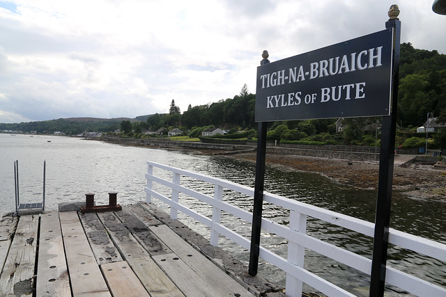
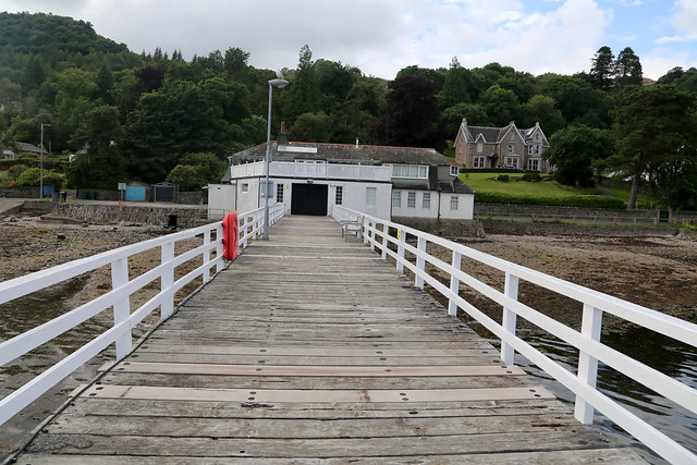
The pier isn’t really a pleasure pier as such (there are no arcades, theatres or the like) but more for boats to dock, exactly as Waverley has just done but I suspect it is not much used these days by boats. A side gate gives access and I enjoy the view from it although some of the planks feel quite wobbly.
Anyway I head back on the pier to the road and continue south. The hotel at which I am staying is about another mile up the road, by the junction of the B8000 (as the road I am on has come) and the A8003 (which ends there).


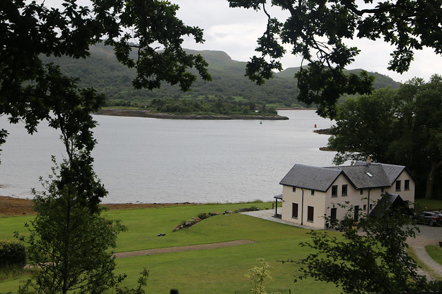
Soon I can see it, knowing what it looks like having parked there this morning.

I soon reach the hotel I have booked, the Royal an Lochan and check in. I never know quite what to expect in small independent hotels. I’ve had some good ones and some bad ones (and not a lot in between). This one turns out to be one of the former. I have a large double room which is spotlessly clean and recently decorated with a thick carpet (I have to try not to get too much mud on it!) and a large bath which is nice. It is not the cheapest but at least it’s good.
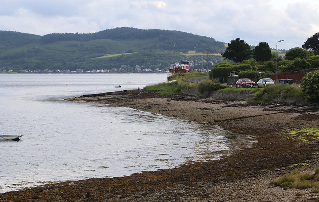
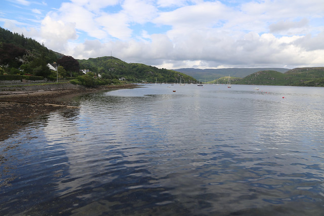
The setting is lovely right by the shore. Before dinner I decide to continue along the road a little more down to Kames, the next village a little over half a mile to the south. This takes me past the shinty pitch (not football! – thanks Alan) and later the small shop in Kames.

It is a nice setting and I soon head back to the hotel. Although a small hotel (I think there are around 15 rooms) I am pleased it has a restaurant (and bar) so I don’t have to go anywhere else to get an evening meal and it is in a conservatory at the front with a lovely view. Although I haven’t booked a table (and never did, during my stay) the manager always finds room for me each night when I ask if there is space at the reception desk. For a small place in a rural setting the menu has a good selection and the food turns out to be really excellent each night. I’m not a fussy eater at all anyway but the presentation is beautiful, it tastes lovely and the portions are a good size (often pretty food means tiny portions!) so it is a nice way to end the day.
This was a really enjoyable walk. Right beside the coast and with lovely views and a good variety of scenery too and no problems finding a good route. Whilst the path section was tough going it was also very enjoyable and I felt a good sense of achievement when I made it through to the road at the other side.
Here are details of the public transport needed for this walk:-
West Coast Motors route 478 : Portavadie – Millhouse – Kames – Tighnabruaich – Colintraive – Auchenbreck – Ardtaraig – Clachaig – Sandhaven – Sandbank – Dunoon. Approximately 6 buses per day Monday – Friday (some varying depending on whether it is a school day or not). 4 buses per day on Saturday. No service on Sunday. It takes around 25 minutes to travel between Colintraive and Tighnabruaich.
Here are the complete set of photos for this walk : Album.
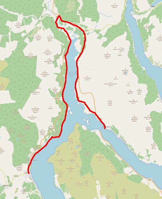
Here is a map of this walk:-

How lovely to read this on the bus from Tarbet, heading for Glasgow and then home. I walked that challenging stretch of coast through the rhododendron jungle only two days ago. Loved it but what a challenge. The path was just a stream tumbling down over rocks. Took me an hour to cover a mile. I also ended up with wet feet crossing the stream with the bridge lying on the bank!
Sounds a lovely trip Tony and I look forward to hearing about it. I’m glad it wasn’t just me that found that part of the Cowal Way to be tough and I imagine it’s even worse with the lack of bridge given the amount of rain we’ve had this year. Still sounds like you enjoyed it (as I did).
Hi Jon, I too enjoyed this walk. You probably knew that it was The Cowal Way you were on? There was a lot more ‘aids’ to get you over the rocky stuff when I walked it, I could see parts of it lying on the ground from some of your photos. Mechan was a Norse warrior, who was killed on his way to the battle of Largs in 1263, it was very difficult deciphering the words on his stone due to lichen.
Right Jon! Hang your head in shame! The local Shinty players of Kames would be mortified to hear their ground described as a “small football pitch” LOL.
Looking forward to the next report.
Hi Alan yes I was aware that part was the Cowal Way. I enjoyed the path despite being hard. Thanks for the information about Mechan, too.
As to Shinty, well, ooops. I’ve corrected it now and thanks for pointing that out before I cause any further offence!